
Order Total (1 Item Items):
Shipping Destination:

Angus Dunphy (44 results)
Skip to main search results
Product Type
- All Product Types
- Books (27)
- Magazines & Periodicals
- Comics
- Sheet Music
- Art, Prints & Posters
- Photographs
- Maps (17)
-
Manuscripts &
Paper Collectibles
Condition
Binding
Collectible Attributes
- First Edition (2)
- Signed
- Dust Jacket (7)
- Seller-Supplied Images (4)
- Not Printed On Demand
Seller Location
Seller Rating
-
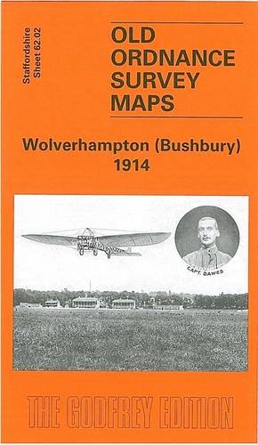
Wolverhampton (Bushbury) 1914: Staffordshire Sheet 62.02 (Old O.S. Maps of Staffordshire)
Published by Alan Godfrey Maps, 2005
ISBN 10: 184151702XISBN 13: 9781841517025
Book
Paperback. Condition: Very Good. The book has been read, but is in excellent condition. Pages are intact and not marred by notes or highlighting. The spine remains undamaged.
More buying choices from other sellers on AbeBooks
New offers from US$ 3.88
Used offers from US$ 1.98
Also find Softcover
-
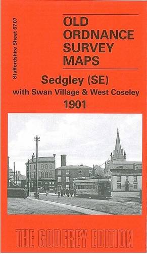
Sedgley (SE) with Swan Village and West Coseley 1901: Staffordshire Sheet 1901 (Old O.S. Maps of Staffordshire)
Published by Alan Godfrey Maps, 1997
ISBN 10: 0850549388ISBN 13: 9780850549386
Book
Map. Condition: Good. All orders are dispatched the following working day from our UK warehouse. Established in 2004, we have over 500,000 books in stock. No quibble refund if not completely satisfied.
More buying choices from other sellers on AbeBooks
New offers from US$ 8.44
Used offers from US$ 3.17
-

Sedgley (NE) and Deepfields 1901: Staffordshire Sheet 67.03 (Old O.S. Maps of Staffordshire)
Published by Alan Godfrey Maps, United Kingdom, Co Durham, 1998
ISBN 10: 0850549442ISBN 13: 9780850549447
Book
Paperback. Condition: Very Good. The book has been read, but is in excellent condition. Pages are intact and not marred by notes or highlighting. The spine remains undamaged.
More buying choices from other sellers on AbeBooks
New offers from US$ 4.86
Used offers from US$ 5.29
Also find Softcover
-

Penn in Print: Millennium Edition
Published by Angus Dunphy, 1999
ISBN 10: 0952200414ISBN 13: 9780952200413
Book
Paperback. Condition: Very Good. The book has been read, but is in excellent condition. Pages are intact and not marred by notes or highlighting. The spine remains undamaged.
More buying choices from other sellers on AbeBooks
Used offers from US$ 6.68
-

Supporting Muslim Students: A Quick Reference Guide for Teachers, Trainers and Lecturers 2017
Published by John Catt Educational Ltd, 2020
ISBN 10: 1911382292ISBN 13: 9781911382294
Book
Paperback. Condition: Brand New. 72 pages. 8.27x5.83x0.32 inches. In Stock.
More buying choices from other sellers on AbeBooks
New offers from US$ 13.65
-

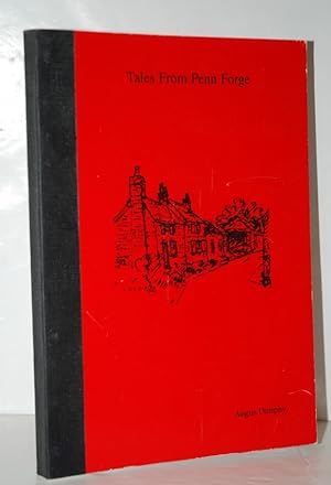
Tales from Penn Forge
Publication Date: 2002
Seller: Manning's Books & Prints, ABAA, Pacifica, CA, U.S.A.
Seller Rating:

Book
Paperback. Condition: Very Good. typed and designed by Mari Dunphy. VERY GOOD condition - small stain lower edge corner. paperback.
-
OUT AND ABOUT IN PENN (AND DISTRICT) (A FIRST PRINTING)
Published by SELF PUBLISHED,UK, 1990
Book First Edition
Soft cover. Condition: Very Good. 1st Edition. UK1ST.EDITION.1ST.PRINTING.VG SOFTWRAPS IN A RINGED PLASTIC SPINE.88 PAGES.70.
-
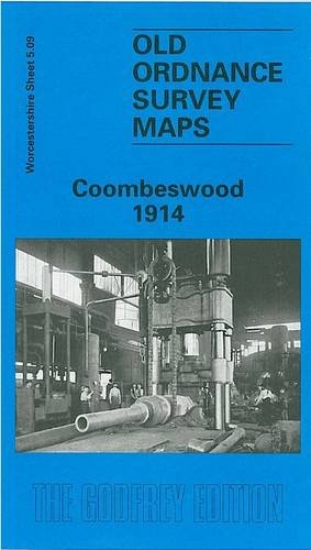
Coombeswood 1914: Worcestershire Sheet 5.09
Published by Alan Godfrey Maps, 1998
ISBN 10: 1841510025ISBN 13: 9781841510026
Map
No Binding. Condition: New. No Jacket. Here are the details of maps for Coombeswood: Worcestershire Sheet 5.09 Coombeswood 1914 - published 1998; intro by Angus Dunphy. ISBN.978-1-84151-002-6 This detailed map covers part of the Halesowen hamlets of Hill, Cakemore and Coombeswood. Coverage stretches from Lewis Lane eastward to Ridgacre Road, and from Maltmill Lane southward to Furnace Lane. Features include a short stretch of the GWR Netherton & Halesowen line, The Furnace, Heywood Forge with mineral railway, Mucklow Hill, Greenhill Farm, Long Lane area, Coombeswood Tube Works, Gorsty Hill, Cockshot, Olivehill Farm, Haggs Farm, Coombes Wood Colliery, Dudley Canal etc. On the reverse we include a section of the 1st Edition 1883 map for the Mucklow Hill area westward to The Furnace. The map links up with Worcestershire sheets 4.12 Cradley South to the west, 5.10 Quinton to the east and 5.13 Halesowen East to the south; and Staffordshire sheet 72.05 Rowley Regis to the north.
-
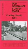
Cradley (South) 1901: Worcestershire Sheet 4.12 (Old Ordnance Survey Maps of Worcestershire)
Published by Alan Godfrey Maps, 2001
ISBN 10: 1841512435ISBN 13: 9781841512433
Book
No Binding. Condition: New. No Jacket. Here are the details of maps for Cradley (E): Worcestershire Sheet 4.12 Cradley (South) 1901 - published 2001; intro by Angus Dunphy. ISBN.978-1-84151-243-3 This detailed map covers the eastern part of Cradley, southern part of Cradley Heath, the Haden Hill and Haden Cross area, and a rural portion of Hawne parish. Features include Corngreaves Works, Hightown and Overend areas of Cradley, Toy's Green, Colonial Works, Colley Orchard, New Hawne Colliery with mineral railway, Colmanhill House, Timbertree Colliery with tramway, Corngreaves Hall, Surfeit Hill, St Peter's church (split by margin), disused Codsall Colliery, Haden Hill, Haden Cross, Old Hawne Colliery (disused), Gunbarrel Mill, Tadpole Hole, Granville & Gorstyhill Colliery (disused), stretch of GWR Netherton & Halesowen branch, River Stour etc. On the reverse we include an 1896 Cradley directory. The map links up with Worcestershire sheets 4.11 Lye to the west, 5.09 Combeswood to the east, 4.16 Halesowen West to the south and Staffordshire sheet 71.08 Cradley Heath to the north.
-
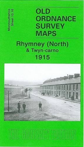
Rhymney (North) and Twyn-carno 1915: Monmouthshire Sheet 10.16 (Old O.S. Maps of Monmouthshire)
Published by Alan Godfrey Maps, 2006
ISBN 10: 1841519448ISBN 13: 9781841519449
Map
No Binding. Condition: New. No Jacket. Here are the details of maps for Rhymney: Monmouthshire Sheet 10.16 Rhymney (North) & Twyn-carno 1915 - published 2006; intro by Angus Dunphy. ISBN.978-1-84151-944-9 This very detailed map covers the northern part of Rhymney. The map covers the area of Rhymney around High Street, from Tre-York Street and Manest Street northward to Twyn-carno and Ras Bryn-oer; features include the Brewery, Queens Crescent, Church Street, St David's church, Royal Arms Hotel, Carno House. Several old quarry and mine workings are shown, including the disused Waun-fawr and Twyn-carno pits. The eastern part of the map is moorland, helping put Rhymney into the context of its landscape. On the reverse we include a directory of Rhymney in 1906. The map links up with sheet 11.13 Tredegar South to the east, 16.04 Rhymney South to the south.
-
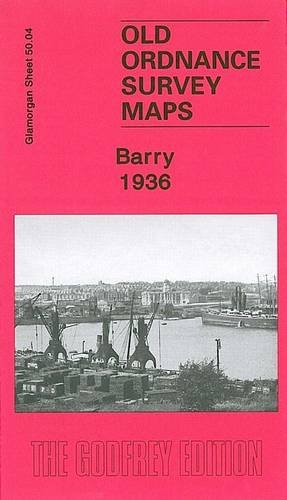
Barry 1936: Glamorgan Sheet 50.04 (Old Ordnance Survey Maps of Glamorgan)
Published by Alan Godfrey Maps, 2007
ISBN 10: 1847840698ISBN 13: 9781847840691
Map
No Binding. Condition: New. No Jacket. Here are the details of maps for Barry: Glamorgan 50.04a Barry 1898 - published 2007; intro by Angus Dunphy. ISBN.978-1-84784-069-1 Glamorgan 50.04b Barry 1936 - published 2013; intro by Derrick Pratt. ISBN.978-1-84784-646-4 We have published two versions of this map, showing how the area changed across the years. The maps cover much of the town of Barry, which sprang up rapidly after 1884 as a mighty coal exporting port. Coverage stretches from Pontypridd Road and Salisbury Road eastward to Morel Street and George Street, and from North Walk southward to the No.1 Dock. The northern part of the No.1 Dock is shown, with detail including a dozen of the coal hoists, with railway sidings, the detail even including mooring posts. Other features on the map include GWR General Offices, locomotive repairing works, Jenner Park football ground, municipal buildings, Memorial Hall, Glamorgan Training College, Alexandra Gardens, St Paul's church and many streets of housing. Each map includes extracts from a 1906 directory. The map links up with sheet 50.08 Barry Island to the south.
-
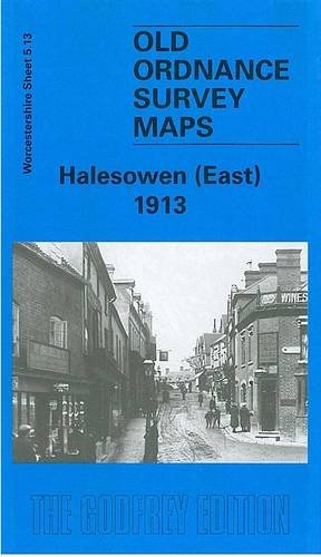
Halesowen (East): Worcestershire Sheet 5.13
Published by Alan Godfrey Maps, 1999
ISBN 10: 184151053XISBN 13: 9781841510538
Map
No Binding. Condition: New. No Jacket. ere are the details of maps for Halesowen (E): Worcestershire Sheet 5.13 Halesowen (East) 1913 - published 1999; intro by John Maddison. ISBN.978-1-84151-053-8 This detailed map covers the eastern part of Halesowen, with coverage extending eastward to Lapal Farm and Carter's Lane. Features include Halesowen & Northfield railway with Halesowen station, Dudley Canal, Heywood Bridge, Hagley Street and Cornbow area of Halesowen town, The Grange, St Mary's Abbey, Furnace Hill, Lapal House, The Leasows, Webb's Green. On the reverse we include a list of private residents for Halesowen in 1896, plus a railway timetable for the Halesowen-Rubery line. The map links up with Worcestershire sheets 4.16 Halesowen West to the west, 5.09 Coombeswood to the north.
-
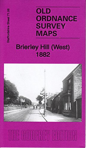
Brierley Hill (West) 1882: Staffordshire Sheet 71.06a (Old Ordnance Survey Maps of Staffordshire)
Published by Alan Godfrey Maps, 2015
ISBN 10: 1847848699ISBN 13: 9781847848697
Map
No Binding. Condition: New. Dust Jacket Condition: New. Here are the details of maps for Brettell Lane: Staffs 71.06a Brierley Hill (West) 1882 - published 2015; intro by Angus Dunphy. ISBN.978-1-84784-869-7 Staffs 71.06b Brierley Hill (West) & Brettell Lane 1901 - published 1997; intro by John Boynton. ISBN.978-0-85054-909-6 We have published two versions of this map, covering a busy industrial area including the western part of Brierley Hill, with the Brettell Lane and Audnam areas. They show how the area changed across the years. Coverage stretches from Audnam House eastward to Hill St, Brierley Hill. Features include Audnam Glass Works, Camp Hill, Stourbridge Canal, Dudley Canal, Brierley House, Buckpool, Nagersfield Fire Brick Works, Dennis Park, Brettell Lane area with Fire Brick Works, GWR railway with Brierley Hill and Brettell Lane stations, Clattershall Works, Brettell Lane House, Brierley Iron Foundry, Delph Works, tramways, Church Hill, Chapel Hill, St Michael's church, Glass Works, Bottle Works, Silver End area, Turners Lane Colliery etc. The map links up with Staffordshire sheets 71.02 Brockmoor to the north, 71.05 Wordsley to the west, 71.07 Brierley Hill East to the east and Worcestershire sheet 4.10 Stourbridge North to the south.
-
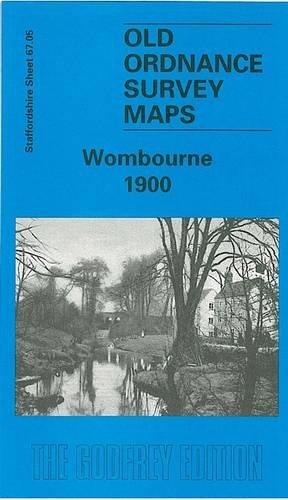
Wombourne 1900: Staffordshire Sheet 67.05 (Old O.S. Maps of Staffordshire)
Published by Alan Godfrey Maps, 2000
ISBN 10: 1841511374ISBN 13: 9781841511375
Map
No Binding. Condition: New. Dust Jacket Condition: New. Here are the details of maps for Wombourne: Staffordshire Sheet 67.05 Wombourne 1900 - published 2000; intro by Angus Dunphy. ISBN.978-1-84151-137-5 This detailed map covers a largely rural area SW of Wolverhampton, of which the main feature is the village of Wombourne. Features include St Benedict's church, Old Bush Inn, Duneden, Greenhill House, Rushford Slang, The Wodehouse, The Foxhills, Woody Park. On the reverse we include a portion of adjacent sheet 67.09 extending coverage south to include Himley Hall. A directory of Wombourne is also included. The map links up with Staffordshire sheets 67.06 Sedgley West to the east.
-
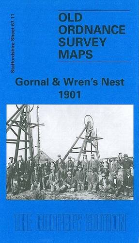
Gornal and Wren's Nest 1901: Staffordshire Sheet 67.11 (Old O.S. Maps of Staffordshire)
Published by Alan Godfrey Maps, 1998
ISBN 10: 184151022XISBN 13: 9781841510224
Map
No Binding. Condition: New. Dust Jacket Condition: New. Here are the details of maps for Gornal: Staffordshire Sheet 67.11 Gornal & Wren's Nest 1901 - published 1998; intro by Angus Dunphy. ISBN.978-1-84151-022-4 This detailed map covers the NW part of Dudley incl Shavers End and London Fields; coverage continues westward to Lower Gornal, northward to Upper Gornal. The map doubles as Worcestershire sheet 1.11. Features on the map include Dudley Workhouse, tramways, football ground, Russell's Hall, Woodsellor's Farm, Wren's Nest Hill, Old Priory Farm, London Fields Works, Dibdalebank, Dibdale Works, Graveyard, Dibdale Colliery, Upper Gornal Colliery, Ruiton, brick works, old coal shafts etc. The map is less industrial than most others in the area. On the reverse we include directories of Upper and Lower Gornal. The map links up with sheets 67.07 Sedgley SE to the north, 67.10 Gornalwood to the west, 67.12 Dudley Castle to the east, 67.15 Dudley West to the south.
-

Gornalwood and Himley Coalfield 1901: Staffordshire Sheet 67.10
Published by Alan Godfrey Maps, 1999
ISBN 10: 1841510599ISBN 13: 9781841510590
Map
No Binding. Condition: New. Dust Jacket Condition: New. Here are the details of maps for Gornalwood: Staffordshire Sheet 67.10 Gornalwood & Himley Coalfield 1901 - published 199; intro by Angus Dunphy. ISBN.978-1-84151-059-0 This detailed map covers the covers Gornalwood, and the area westward to Straits Green (in the centre of the map) and Himley Wood. Features on the map include St John's church, chapels, Redhall, old coal shafts, Ruiton Farm, Ellowes Hall, brick works, Straits Green, Turner's Hill Wood, Turner's Hill, Wallows Wood, Gordon's Place, Straits House, Himley Colliery, Higharcal, mineral railway and tramway, Himley Wood etc. On the reverse we include a section of the Revision of 1913, showing the Himley Colliery area at a later date. The map links up with sheets 67.06 Sedgley West to the north, 67.11 Gornal to the east, 67.14 Shut End to the south.
-
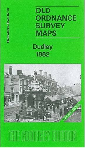
Dudley 1882: Staffordshire Sheet 67.16a (Old Ordnance Survey Maps of Staffordshire)
Published by Alan Godfrey Maps, 2012
ISBN 10: 1847845886ISBN 13: 9781847845887
Map
No Binding. Condition: New. Dust Jacket Condition: New. Here are the details of maps for Dudley: Staffs Sheet 67.16a Dudley 1882 - published 2012; intro by Angus Dunphy. ISBN.978-1-84784-588-7 Staffs Sheet 67.16b Dudley 1901 - published 1997; intro by David Radmore & Samantha Robins. ISBN.978-0-85054-937-9 Staffs Sheet 67.16c Dudley 1914 - published 2017; intro by Barrie Trinder. ISBN.978-1-78721-111-7 We have published three versions of this detailed map, showing how the area developed across the years: it covers the central area of Dudley, and coverage then extends eastward to Kate's Hill, Cawney Hill and Oakham. The map covers parts of both Staffordshire and Worcestershire and doubles as Worcs sheet 1.16. Features on this busy map include Dudley town centre in detail, with individual buildings neatly delineated, including Town Hall, Market Place, High Street area, St Thomas church, St Edmund's church, Waddam's Pool Works, St Mary & St Thomas RC Chapel, Netherton station, Paradise. Features elsewhere include Tansleyhill Colliery, Dixon's Green, Prince of Wales Pit (disused), Cawneyhill House, St John's church, Roseland Farm, Oakham Lodge, Burnt Tree Colliery (disused), industrial tramway and incline, Oakham Colliery (disused), line of Netherton Tunnel, Tansley Hill, old coal shafts etc. The 1882 version is fully coloured, taken from the OS 1st Edition handcoloured map. The map links up with sheets 67.12 Dudley Castle to the north, 67.15 Dudley West to the west, 68.13 Brades Village to the east, 71.04 Netherton to the south.
-
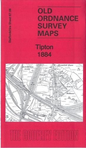
Tipton 1884: Staffordshire Sheet 67.08a (Old Ordnance Survey Maps of Staffordshire)
Published by Alan Godfrey Maps, 2018
ISBN 10: 1787211487ISBN 13: 9781787211483
Map
No Binding. Condition: New. Dust Jacket Condition: New. Here are the details of maps for Tipton & Bloomfield: Staffs 67.08a Tipton 1884 - published 2018; intro by Angus Dunphy. ISBN.978-1-78721-148-3 Staffs 67.08b Tipton 1904 - published 1989; intro by Robin Pearson. ISBN.978-0-85054-225-7 Staffs 67.08c Tipton 1914 - published 2017; intro by Barrie Trinder. ISBN.978-1-78721-104-9 We have published thee versions of this map, showing how the area changed across the years. They cover a busy industrial area that includes Bloomfield, Princes End, much of central Tipton, Summer Hill and the southern tip of Coseley. Features include Birningham Canal, Wolverhampton Level and Birmingham Level; tramways, LNWR Stour Valley Line with Tipton station, GWR Oxford Worcester & Wolverhampton line with Princes End and Tipton stations; Tipton Green Blast Furnaces, Moat Foundry, Tipton Engineering Works, Adelaide Tube Works, Moat Colliery, Horseley Colliery, Tibbington Collieries, Empire Colliery, Lloyd's Proving House, Foxyards Fire Brick Works, Foxyards Colliery, many disused collieries and coal shafts, canal basins, old industrial landscape. The map links up with Staffordshire sheets 67.04 Bradley to the north, 67.07 Sedgley SE to the west, 68.05 Great Bridge to the east, 67.12 Dudley Castle to the south.
-
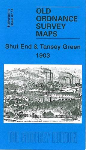
Shut End and Tansey Green 1903: Staffordshire Sheet 67.14 (Old Ordnance Survey Maps of Staffordshire) O/S
Published by Alan Godfrey Maps, 2006
ISBN 10: 1841518875ISBN 13: 9781841518879
Map
No Binding. Condition: New. Here are the details of maps for Tansey Green: Staffordshire Sheet 67.14 Shut End & Tansey Green 1903 - published 2006; intro by Angus Dunphy. ISBN.978-1-84151-887-9 This detailed map covers an area west of Dudley that was rich in industry, vividly portrayed here. The map includes the northern fringe of Kingswinford, including St Mark's church and St Mary's church, but transport and industry dominate. Features include the Stourbridge Extension Canal, GWR Kingswinford Branch, numerous mineral railways, Planet Colliery, Shutend Colliery, Stourbridge Extension Colliery, Shutend Old Colliery, Himley Colliery, several disused pits, Corbyn's Hall iron works, Oak Farm brick works, Hunt's corn mill, several brick works, tramway. Angus Dunphy's essay provides a full history to this area, which was already in decline. Directories to Kingswinford and Pensnett are also included. The map links up with Staffordshire Sheet 67.10 Gornalwood to the north, 67.13 Wall Heath to the west, 67.15 Dudley West to the east and 71.02 Brockmoor to the south.
-
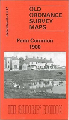
Penn Common 1900: Staffordshire Sheet 67.02 (Old O.S. Maps of Staffordshire) O/S
Published by Alan Godfrey Maps, 1997
ISBN 10: 0850548748ISBN 13: 9780850548747
Map
No Binding. Condition: New. Here are the details of maps for Penn Common: Staffordshire Sheet 67.02 Penn Common 1900 - published 1997; introduction by Angus Dunphy This detailed map covers a largely rural area west of the Black Country, with coverage extending from Nash's Coppice eastward to Sedgley Hall, and northward to Greenleighs. Features include St Bartholomew's church, Turf Tavern, Old Race Course, Penn Common, golf course, Penn Brewery, Penn Brook, Pennwood Farm, Alder Coppice. On the reverse we include a directory of Penn or Upper Penn. The map links up with Staffordshire sheets 62.14 Upper Penn to the north, 67.03 Sedgley NE to the east, 67.06 Sedgley West to the south.
-
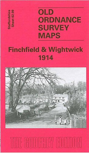
Finchfield and Wightwick 1914: Staffordshire Sheet 62.09 (Old O.S. Maps of Staffordshire) O/S
Published by Alan Godfrey Maps, 2005
ISBN 10: 1841518026ISBN 13: 9781841518022
Book
No Binding. Condition: New. No Jacket. Here are details of the map for Finchfield: Staffordshire Sheet 62.09 Finchfield & Wightwick 1914 - published 2005; intro by Angus Dunphy. ISBN.978-1-84151-802-2 This detailed map covers a largely rural area SW of Wolverhampton. It includes Finchfield, incl Finchfield House, Bhylls, Finchfield Farm, Horsehill Terrace, Washington House etc. Coverage extends westward to part of Wightwick, in the top left corner of map, incl Wightwick Manor and Wightwick House. Other features include Castlecroft, Staffordshire & Worcestershire Canal. The Oxley Jct to Kingswinford Jct railway is shown as 'under construction'. On the reverse we include directories of Compton and Wightwick. The map links up with Staffordshire sheets 62.05 Tettenhall to the north, 62.10 Wolverhampton SW to the east.
-

Upper Penn 1901: Staffordshire Sheet 62.14
Published by Alan Godfrey Maps, 1996
ISBN 10: 0850548152ISBN 13: 9780850548150
Map
No Binding. Condition: New. Here are details of the map for Upper Penn: Staffordshire Sheet 62.14 Upper Penn 1901 - published 1996; intro by Angus Dunphy. ISBN.978-0-85054-815-0 This detailed map covers the southern part of Wolverhampton around Goldthorn Hill, with coverage extending southward to Sedgley Park and SW to Upper Penn. Features include St Philip's church, Coalway Farm, Upper Penn village, Muchall Hall, Muchall Grove, Manor House, Penn Court, Colton Hills, Penn Brick Works, Muchall Farm, Goldthorn Hill area, Penn Fields area, reservoirs, Goldthorn House, Sedgley Park Farm. On the reverse we include directories for Penn and Penn Fields, with street directory entries for Chequer Street, Coalway Lane, Eagle Street and Penn Road. The map links up with Staffordshire sheets 62.10 Wolverhampton SW to the north, 62.15 Ettingshall to the east, 67.02 Penn Common to the south.
-
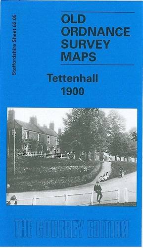
Tettenhall 1900: Staffordshire Sheet 62.05 O/S
Published by Alan Godfrey Maps, 2005
ISBN 10: 1841517712ISBN 13: 9781841517711
Map
No Binding. Condition: New. Here are details of the map for Tettenhall: Staffordshire Sheet 62.05 Tettenhall 1900 - published 2005; intro by Angus Dunphy. ISBN.978-1-84151-771-1 This detailed map covers most of Tettenhall, including Tettenhall Wood, west of Wolverhampton. Coverage extends from Tettenhall Upper Green southward to Compton Hall. Features include Tettenhall Wood House, Christ Church, Compton Hill, Elmsdale Hall, Dippons Farm, Long Lake, Tettenhall Towers, Tettenhall College, Manor House, Lower Green, Upper Green, Gorsty Hayes Manor House, Staffordshire & Worcestershire Canal, Compton. On the reverse we include 1912 directories of Tettenhall, Compton and Tettenhall Wood. The map links up with Staffordshire sheets 62.06 Wolverhampton NW to the east, 62.09 Finchfield to the south.
-
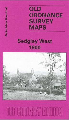
Sedgley West 1900: Staffordshire Sheet 67.06 (Old O.S. Maps of Staffordshire) O/S
Published by Alan Godfrey Maps, 1997
ISBN 10: 0850549027ISBN 13: 9780850549027
Map
No Binding. Condition: New. Here are the details of maps for Sedgley (W): Staffs Sheet 67.06a Sedgley (West) 1900 - published 1997; intro by Angus Dunphy.ISBN.978-0-85054-902-7 Staffs Sheet 67.06b Sedgley (West) 1938 - published 2014; intro by Malcolm Nixon.ISBN.978-1-84784-848-2 We have published two versions of this map, showing how the area changed across the years. Each covers the area from Gospel End eastward to Cotwall End. Features include Sandyfields, Whites Wood, Gospel End, Netherby House, Cotwallend House, Baggeridge Colliery, Askew Bridge Branch. The map links up with Staffordshire sheets 67.02 Penn Common to the north, 67.05 Wombourne to the west, 67.07 Sedgley SE to the east, 67.10 Gornalwood to the south.
-
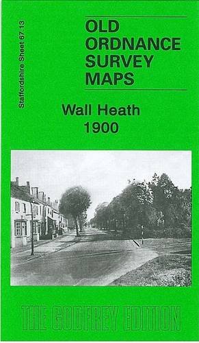
Wall Heath 1900: Staffordshire Sheet 67.13 (Old Ordnance Survey Maps of Staffordshire) O/S
Published by Alan Godfrey Maps, 2008
ISBN 10: 184784183XISBN 13: 9781847841834
Book
No Binding. Condition: New. No Jacket. Here are the details of maps for Wall Heath: Staffordshire Sheet 67.13 Wall Heath 1900 - published 2008; intro by Angus Dunphy. ISBN.978-1-84784-183-4 This detailed map covers the village of Wall Heath, in Kingswinford parish. Coverage stretches from Holbeche House southward to Ashwood House and Dawley Brook, and from Hinksford Farm, eastward to Stalling's Farm and Himley Colliery. The area is best known for Holbeche or Holbeach House, where the Gunpowder Plot particpants were arrested. Other features include mineral railway with sidings into sand pits, Wall Heath Forge, Dawleybrook Wharf, Heathbrook arm, Himley Colliery Pits 7 and 8, Elmtree House etc. On the reverse we include a directory of Kingswinford and Wall Heath. The map links up with sheets 67.14 Shut End to the east and 71.01 Kingswinford to the south.
-
Tales from Penn Forge Penn, Wolverhampton
Published by Angus Dunphy, 2003
ISBN 10: 0952200473ISBN 13: 9780952200475
Book
Paperback. Condition: Fair. General wear to the book, cover, edges and corners, light scratches plus sticker residue mark to vack cover. Internally Very Good - clean and tidy copy in tight binding. A Very Good personal copy. **372g ** All orders are sent with a tracking /signature service for your peace of mind, so that you can keep tabs on your parcel. For overseas customers - on some sites we use, parcels weighing over the standard rate may incur an additional charge and we will then contact you with the additional shipping fee required. This is for the postage only we do not charge you for our time or our excellent packaging, which we are noted for. Dispatched in cardboard mailers within 24/48 Hours Mon - Friday 2pm, except bank holidays, otherwise next business day - excellent service guaranteed.
-
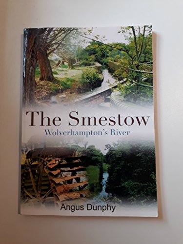
The Smestow Wolverhampton's River
Published by Black Country Society, 2012
ISBN 10: 0904015815ISBN 13: 9780904015812
Book
Paperback. Condition: Very Good. 156pp, illustrated, paperback ; Large quarto; 156 pages.
-
The West Midlands airfields
Published by The Ellowes Hall School and Dudley Teachers' Centre, 1978
First Edition
1st ed. A well-done amateur publication; blue card covers with blue cloth spine; front cover a little faded, corners slightly softened, glue marks on first hinge; pages a little foxed on edges, otherwise neatly preserved. This is a heavy book (about 2.5kg packed); additional postage may be required Used - Good. Good large format paperback.
-
Hardback. F A Barnett (illustrator). 437pp Errata Index to rear. Blue cloth spine (detached from rear cover). Pale blue card covers. General shelf wear to extremities. An unusual publication. book.
-
Softback. Condition: GOOD. 1983. Dudley Teachers' Centre. Softback. GOOD Black illustrated, photocopied titles, blue card cover, type script. Canadian spine,
