
Order Total (1 Item Items):
Shipping Destination:

Bristol 1913 Gloucestershire Sheet (6 results)
Skip to main search results
Product Type
- All Product Types
- Books (2)
- Magazines & Periodicals
- Comics
- Sheet Music
- Art, Prints & Posters
- Photographs
- Maps (4)
-
Manuscripts &
Paper Collectibles
Condition
Binding
- All Bindings
- Hardcover
- Softcover (1)
Collectible Attributes
- First Edition
- Signed
- Dust Jacket
- Seller-Supplied Images (1)
- Not Printed On Demand
Seller Location
Seller Rating
-
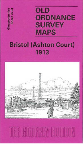
Bristol (Ashton Court) 1913: Gloucestershire Sheet 75.03 (Old O.S. Maps of Gloucestershire)
Published by Alan Godfrey Maps, 2005
ISBN 10: 1841517666ISBN 13: 9781841517667
Map
No Binding. Condition: As New. Like New. It is in excellent condition. The book is from library of former Western Mail journalist, Clive Betts. Fel newydd. Mae'r llyfr mewn cyflwr gwych. Mae'r llyfr yn dod o cyn lyfrgell newyddiadurwr Western Mail, Clive Betts.
-
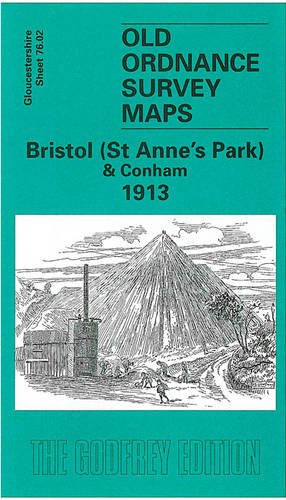
Bristol (St. Anne's Park & Conham) 1913: Gloucestershire Sheet 76.02 (Old O.S. Maps of Gloucestershire)
Published by Alan Godfrey Maps, 2003
ISBN 10: 1841515159ISBN 13: 9781841515151
Book
Paperback. Condition: Very Good. The book has been read, but is in excellent condition. Pages are intact and not marred by notes or highlighting. The spine remains undamaged.
-
Bristol (St. Anne's Park & Conham) 1913: Gloucestershire Sheet 76.02 (Old O.S. Maps of Gloucestershire)
Published by Alan Godfrey Maps, 2003
ISBN 10: 1841515159ISBN 13: 9781841515151
Book
Condition: VeryGood. Most items will be dispatched the same or the next working day.
-
Bristol (Ashton Court) 1913: Gloucestershire Sheet 75.03 (Old O.S. Maps of Gloucestershire)
Published by Alan Godfrey Maps, 2005
ISBN 10: 1841517666ISBN 13: 9781841517667
Map
No Binding. Condition: New. No Jacket. Here are the details of maps for Ashton Court: Gloucestershire Sheet 75.03 Bristol (Ashton Court) 1913 - published 2005; intro by Mike Bone. ISBN.978-1-84151-766-7 This detailed map covers an area to the west of Bristol. Ashton Court is central to the map with Ashton Park extending widely across it. Ashton Vale is in the extreme SE corner, while a small portion of Clifton, including The Paragon and St Vincent's Parade is in the NE corner. Other features include Ashton Vale Works, River Avon with Rownham Ferry, Frayne's Colliery (disused), GWR Portishead line with Ashton Gate Platform and Clifton Bridge station, entrance lock to Cumberland Basin, Rownham House, Bower Ashton. On the reverse we include a directory of Long Ashton plus a timetable for the Portishead Branch. The map links up with sheets 71.15 Clifton Down to the north, 75.04 Bristol SW to the east and 75.07 Long Ashton to the south.
-
Bristol (St. Anne's Park & Conham) 1913: Gloucestershire Sheet 76.02 (Old O.S. Maps of Gloucestershire)
Published by Alan Godfrey Maps, 2003
ISBN 10: 1841515159ISBN 13: 9781841515151
Map
No Binding. Condition: New. No Jacket. Here are the details of maps for Conham: Gloucestershire Sheet 76.02 Bristol (St Anne's Park) & Conham 1913 - published 2003; intro by Mike Bone. ISBN.978-1-84151-515-1 This detailed map covers an area to the east of Bristol, with coverage stretching from the St Anne's Park area eastward to Conham, Jefferies Hill and the western part of Hanham (junction of Jefferies Hill and Hanham Street is at eastern edge of map). Features include St Anne's Park station, Wick House, River Avon, Conham, Conham Hall, Tar & Rosin Works, quarries, New Brislington Bridge, Hanham Colliery with tramway to river, Jefferies Hill, Christ Church, boot factory, Hanham Street etc. On the reverse we include directories of Brislington and Hanham. The map links up with sheets 72.14 St Georges to the north, 76.01 Bristol SE to the west and 76.06 Brislington to the south.
-
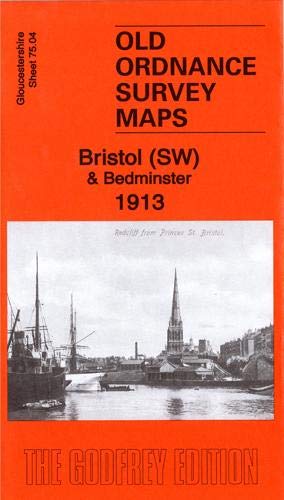
Bristol (SW) & Bedminster 1913: Gloucestershire Sheet 75.04b (Old Ordnance Survey Maps of Gloucestershire)
Published by Alan Godfrey Maps, 2019
ISBN 10: 1787212696ISBN 13: 9781787212695
Map
No Binding. Condition: New. No Jacket. Here are the details of maps for Bristol SW: Gloucs Sheet 75.04a Bristol (SW) & Bedminster 1902 - published 1998; intro by Alan Godfrey. ISBN.978-1-84151-009-5 Gloucs Sheet 75.04b Bristol (SW) & Bedminster 1913 - published 2019; intro by Mike Bone. ISBN.978-1-78721-269-5 We have published two versions of this map, showing how the area changed across the years. The maps cover a very busy area of Bristol, including part of the city centre and much of Bedminster. Coverage stretches from Bedminster Park eastward to Bedminster Bridge and St Mary Redcliff church, and from College Green and the Cathedral southward to Pearl Street and Windmill Hill. Major features include tramways, Queen Square, Canon's Marsh, Floating Harbour, River Avon, Bathurst Basin, Royal Hotel, Bathurst Wharf, Prince's Wharf, Great Western Dockyard, gas works, Cumberland Basin, Clifton Wood, Mardyke, Merchants Dock, Hotwells, GWR Harbour Railway. South of the river features include Ashton Gate, Clift House Hospital, Virgina Cavendish Works, tobacco factory, tannery, St John the Baptist church, Deanlane Colliery, tram depot, St Paul's church, small stretch of GWR with Bedminster station, much of Bedminster, etc. On the reverse we include a selection of street directory entries, incl Bedminster Parade, Dowry Parade and Square, East Street, King Street, Redcliff Hill and Street, Stackpool Road, Welsh Back, Whitehouse Street. Each map includes a specially written introduction to the history of the area, together with extracts from an early street directory.