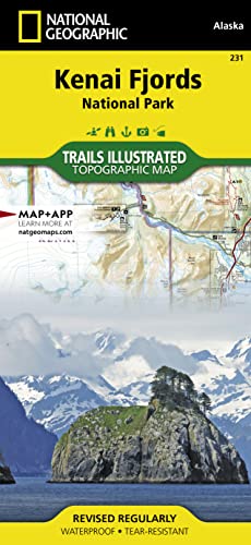
Kenai Fjords National Park Map (National Geographic Trails Illustrated Map, 231)

� Waterproof � Tear-Resistant � Topographic Map
National Geographic's Trails Illustrated map of Kenai Fjords National Park is an essential travel companion for outdoor enthusiasts looking to explore the pristine scenery in this area of southern Alaska. Expertly researched and created in partnership with the National Park Service, U.S. Forest Service and others, the map covers popular recreation and adventure points of interest, such as Harding Icefield, Exit Glacier, Resurrection River and Bay, as well as the adjacent Kenai National Wildlife Refuge, Kachemak Bay State Park and Wilderness Park, Chugach National Forest and Skilak Wildlife Recreation Area. Inset maps of Exit Glacier and Seward provide extra detail of these areas.
The map will guide your exploration, whether on land or on water. Hikers, bikers and ATVers will find clearly marked trails with mileage markers, in addition to contour lines, elevations, labeled peaks, glaciers and crevasses. The Iditarod National Historic Trail and Seward Highway Scenic Byway are both marked. Boaters and kayakers will benefit from the sounding information, tidal flats, boating hazard areas, island locations and pinpointed seabed formation warnings, beacons, anchorage spots and boat ramps. Other recreation points of interest include trailheads, campgrounds, public cabins, food storage lockers, ski trails, waterfalls and scenic viewpoints. The map also includes background information, QR codes for real-time weather and essential contact information.
Every Trails Illustrated map is printed on "Backcountry Tough" waterproof, tear-resistant paper. A full UTM grid is printed on the map to aid with GPS navigation.
Other features found on this map include: Aialik Bay, Bear Glacier, Chernof Glacier, Chiswell Islands, Chugach National Forest, Harris Bay, Kenai Fjords National Park, Kenai Lake, Kenai Mountains, Kenai Peninsula, McCarty Glacier, Nuka Bay, Nuka Island, Pye Islands, Resurrection Bay, Skilak Glacier, Skilak Lake, Tustumena Glacier.
- Map Scale = 1:110,000
- Sheet Size = 25.25" x 38"
- Folded Size = 4.25" x 9.25"
"synopsis" may belong to another edition of this title.
About the Author:
Founded in 1915 as the Cartographic Group, the first division of National Geographic, National Geographic Maps has been responsible for illustrating the world around us through the art and science of mapmaking.Today, National Geographic Maps continues this mission by creating the world's best wall maps, recreation maps, atlases, and globes which inspire people to care about and explore their world.
"About this title" may belong to another edition of this title.
- PublisherNational Geographic Maps
- Publication date2019
- ISBN 10 1566953855
- ISBN 13 9781566953856
- BindingMap
- Number of pages2
Buy New
Learn more about this copy
US$ 16.73
Shipping:
US$ 5.63
From United Kingdom to U.S.A.
Top Search Results from the AbeBooks Marketplace
Stock Image
Kenai Fjords National Park
Published by
National Geographic Maps Division 2013-09-26, Washington, D.C.
(2013)
ISBN 10: 1566953855
ISBN 13: 9781566953856
New
Quantity: 1
Seller:
Rating
Book Description sheet map (folded). Condition: New. Language: ENG. Seller Inventory # 9781566953856
Buy New
US$ 16.73
Convert currency
Stock Image
Kenai Fjords NP AK Trails Illustrated National Parks National Geographic Trails Illustrated Map
Published by
National Geographic Maps Division
(2013)
ISBN 10: 1566953855
ISBN 13: 9781566953856
New
Quantity: 8
Seller:
Rating
Book Description UNK. Condition: New. New Book. Shipped from UK. Established seller since 2000. Seller Inventory # EA-9781566953856
Buy New
US$ 23.90
Convert currency
Stock Image
Kenai Fjords National Park: Trails Illustrated National Parks
Published by
National Geographic Maps
(2019)
ISBN 10: 1566953855
ISBN 13: 9781566953856
New
Quantity: 9
Seller:
Rating
Book Description Sheet map, folded. Condition: New. New copy - Usually dispatched within 4 working days. Seller Inventory # B9781566953856
Buy New
US$ 22.18
Convert currency
Stock Image
National Geographic Kenai Fjords National Park Map: Alaska, USA
Published by
Natl Geographic Society Maps
(1997)
ISBN 10: 1566953855
ISBN 13: 9781566953856
New
Paperback
Quantity: 1
Seller:
Rating
Book Description Paperback. Condition: Brand New. fol map il edition. 2 pages. 9.25x4.25x0.10 inches. In Stock. Seller Inventory # 1566953855
Buy New
US$ 31.73
Convert currency
Stock Image
Kenai Fjords NP AK Trails Illustrated National Parks National Geographic Trails Illustrated Map
Published by
National Geographic Maps Division
(2013)
ISBN 10: 1566953855
ISBN 13: 9781566953856
New
Quantity: 8
Seller:
Rating
Book Description UNK. Condition: New. New Book. Shipped from UK. Established seller since 2000. Seller Inventory # EA-9781566953856
Buy New
US$ 19.25
Convert currency
Seller Image
Kenai Fjords National Park (National Geographic Trails Illustrated Map)
Published by
National Geographic Maps
(2019)
ISBN 10: 1566953855
ISBN 13: 9781566953856
New
Quantity: 1
Seller:
Rating
Book Description Condition: new. Book is in NEW condition. Satisfaction Guaranteed! Fast Customer Service!!. Seller Inventory # PSN1566953855
Buy New
US$ 20.70
Convert currency