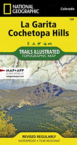
La Garita, Cochetopa Hills Map (National Geographic Trails Illustrated Map, 139)

� Waterproof � Tear-Resistant � Topographic Map
Expertly researched and created in partnership with the U.S. Forest Service, Bureau of Land Manangement and others, National Geographic's Trails Illustrated map of La Garita and Cochetopa Hills provides unmatched detail of this mountainous and forested area in southern Colorado. The map covers parts of San Isabel, Gunnison and Rio Grande National Forests, La Garita and Powderhorn Wilderness Areas, La Garita and San Juan Mountains, Sawatch Range, Silver Thread Scenic Byway and Continental Divide.
Outdoor enthusiasts will be able to get off the beaten track and back on again by following the map to clearly marked trailheads and then along precisely mapped trails, labeled with their designated usage, whether traveling on foot, by mountain bike, motorcycle or snowmobile. The Colorado Trail and Continental Divide Trail, which merge for a large section of the map, are both highlighted. Among the map's many features are contour lines and elevations, labeled peaks and passes, water features and color-coded boundaries between public and private land. Recreation points of interest for all seasons appear as well, including campgrounds, boat launch points, fishing areas, yurts and ski areas.
Every Trails Illustrated map is printed on "Backcountry Tough" waterproof, tear-resistant paper. A full UTM grid is printed on the map to aid with GPS navigation.
Other features found on this map include: Cochetopa Dome, Cochetopa Hills, Gunnison National Forest, La Garita Mountains, La Garita Wilderness, Mesa Mountain, Monarch Pass, Powderhorn Wilderness, Rio Grande National Forest, San Isabel National Forest, San Luis Peak.
- Map Scale = 1:63,360
- Sheet Size = 37.75" x 25.5"
- Folded Size = 4" x 7.5"
"synopsis" may belong to another edition of this title.
About the Author:
Founded in 1915 as the Cartographic Group, the first division of National Geographic, National Geographic Maps has been responsible for illustrating the world around us through the art and science of mapmaking.Today, National Geographic Maps continues this mission by creating the world's best wall maps, recreation maps, atlases, and globes which inspire people to care about and explore their world.
"About this title" may belong to another edition of this title.
- PublisherNatl Geographic Society Maps
- Publication date2019
- ISBN 10 1566953391
- ISBN 13 9781566953399
- BindingMap
- Number of pages2
Buy New
Learn more about this copy
US$ 18.71
Shipping:
FREE
Within U.S.A.
Top Search Results from the AbeBooks Marketplace
Stock Image
La Garita & Cochetopa Area, Colorado - Trails Illustrated Map # 139 (National Geographic Maps: Trails Illustrated)
Published by
Natl Geographic Society Maps
(2008)
ISBN 10: 1566953391
ISBN 13: 9781566953399
New
Quantity: 1
Seller:
Rating
Book Description Map. Condition: New. 3. Seller Inventory # DADAX1566953391
Buy New
US$ 18.71
Convert currency
Stock Image
La GaritaCochetopa Trails Illustrated National Geographic Maps Trails Illustrated National Geographic Trails Illustrated Map
Published by
National Geographic Maps Division
(2012)
ISBN 10: 1566953391
ISBN 13: 9781566953399
New
Quantity: 3
Seller:
Rating
Book Description UNK. Condition: New. New Book. Shipped from UK. Established seller since 2000. Seller Inventory # EA-9781566953399
Buy New
US$ 23.90
Convert currency
Stock Image
La Garita, Cochetopa Hills Map (National Geographic Trails Illustrated Map, 139)
Published by
Natl Geographic Society Maps
(2019)
ISBN 10: 1566953391
ISBN 13: 9781566953399
New
Paperback
Quantity: 1
Seller:
Rating
Book Description Paperback. Condition: new. New. Fast Shipping and good customer service. Seller Inventory # Holz_New_1566953391
Buy New
US$ 19.94
Convert currency
Stock Image
La Garita/cochetopa
Published by
National Geographic Maps Division 2012-08-02, Washington, D.C.
(2012)
ISBN 10: 1566953391
ISBN 13: 9781566953399
New
Quantity: 1
Seller:
Rating
Book Description sheet map (folded). Condition: New. Language: ENG. Seller Inventory # 9781566953399
Buy New
US$ 19.24
Convert currency
Stock Image
La Garita, Cochetopa Hills Map (National Geographic Trails Illustrated Map, 139)
Published by
Natl Geographic Society Maps
(2019)
ISBN 10: 1566953391
ISBN 13: 9781566953399
New
Paperback
Quantity: 1
Seller:
Rating
Book Description Paperback. Condition: new. Buy for Great customer experience. Seller Inventory # GoldenDragon1566953391
Buy New
US$ 22.06
Convert currency
Stock Image
La Garita/cochetopa (Folded)
Published by
National Geographic Maps, Evergreen
(2012)
ISBN 10: 1566953391
ISBN 13: 9781566953399
New
Quantity: 1
Seller:
Rating
Book Description Folded. Condition: new. Folded. National Geographic's Trails Illustrated Maps are the most detailed and up-to-date topographic recreation maps available for US National Parks, National Forests and other popular outdoor recreation areas. A necessity for exploring the outdoors, each map is printed on waterproof, tear-resistant material. They also contain key safety and contact information, GPS and compass coordinates, Leave No Trace ethical guidelines and hundreds of points-of-interest, including scenic viewpoints, campgrounds, boat launches, swimming areas, marine sanctuaries and wildlife refuges. Shipping may be from multiple locations in the US or from the UK, depending on stock availability. Seller Inventory # 9781566953399
Buy New
US$ 28.51
Convert currency
Stock Image
La Garita, Cochetopa Hills Map (National Geographic Trails Illustrated Map, 139)
Published by
Natl Geographic Society Maps
(2019)
ISBN 10: 1566953391
ISBN 13: 9781566953399
New
Quantity: 1
Seller:
Rating
Book Description Condition: New. Buy with confidence! Book is in new, never-used condition. Seller Inventory # bk1566953391xvz189zvxnew
Buy New
US$ 29.72
Convert currency
Stock Image
La Garita, Cochetopa Hills Map (National Geographic Trails Illustrated Map, 139)
Published by
Natl Geographic Society Maps
(2019)
ISBN 10: 1566953391
ISBN 13: 9781566953399
New
Paperback
Quantity: 1
Seller:
Rating
Book Description Paperback. Condition: new. New Copy. Customer Service Guaranteed. Seller Inventory # think1566953391
Buy New
US$ 28.24
Convert currency
Stock Image
La Garita, Cochetopa Hills Map (National Geographic Trails Illustrated Map, 139)
Published by
Natl Geographic Society Maps
(2019)
ISBN 10: 1566953391
ISBN 13: 9781566953399
New
Quantity: 1
Seller:
Rating
Book Description Condition: new. Seller Inventory # FrontCover1566953391
Buy New
US$ 29.77
Convert currency
Stock Image
National Geographic Trails Illustrated Map La Garita / Cochetopa Hills: Colorado
Published by
Natl Geographic Society Maps
(2008)
ISBN 10: 1566953391
ISBN 13: 9781566953399
New
Paperback
Quantity: 1
Seller:
Rating
Book Description Paperback. Condition: Brand New. map edition. 2 pages. 0.25x9.25x4.25 inches. In Stock. Seller Inventory # 1566953391
Buy New
US$ 31.81
Convert currency