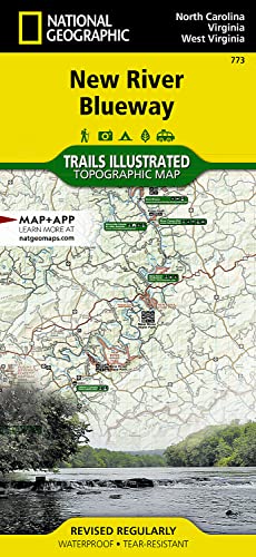
New River Blueway Map (National Geographic Trails Illustrated Map, 773)

� Waterproof � Tear-Resistant � Topographic Map
The New River flows north for over 250 miles from its origination in the Blue Ridge Mountains of North Carolina and snakes through the mountains, rolling hills, and farmland in Virginia, and then rolls on to the steep gorges of West Virginia's coal country. National Geographic's Trails Illustrated map of New River Blueway is designed to meet the needs of outdoor enthusiasts by combining valuable information with unmatched detail of this ancient river and surrounding areas. Created in partnership with local land management agencies, this expertly researched map highlights key areas of interest including Mount Jefferson State Natural Area; New River Trail State Park; Shot Tower Historic Park; and New River, Bluestone, and Claytor Lake state parks. A detailed inset of New River Gorge is provided in the print version of this map.
Whether you're hiking portions of the Appalachian and New River trails, riding the Virginia Highlands Horse Trail, or traveling on the river itself, you'll find trails clearly marked to keep you on the right path. River mileage is noted and a river difficulty scale and safety tips will help keep you out of trouble. An informative summary of each park, as well as outfitter and agency contact information is included as well. Many recreation features are noted, including campgrounds, canoe access, boat launches, trailheads, rental cabins, and areas for skiing, swimming, and fishing. The map base includes contour lines, shaded relief, and elevations for summits.
Every Trails Illustrated map is printed on "Backcountry Tough" waterproof, tear-resistant paper. A full UTM grid is printed on the map to aid with GPS navigation.
Other features found on this map include: Blacksburg, Blue Ridge, Bluestone Lake, Boone, Claytor Lake, Clinch Mountain, East River, Flat Top Mountain, Greenbrier River, Iron Mountains, Jefferson National Forest, Lick Mountain, Mount Rogers, Mountain Lake Wilderness, New River Gorge, Peters Mountain, Sinking Creek, Stone Mountains.
- Map Scale = 1:110,000
- Sheet Size = 25.5" x 37.75"
- Folded Size = 4.25" x 9.25"
"synopsis" may belong to another edition of this title.
About the Author:
Founded in 1915 as the Cartographic Group, the first division of National Geographic, National Geographic Maps has been responsible for illustrating the world around us through the art and science of mapmaking.Today, National Geographic Maps continues this mission by creating the world's best wall maps, recreation maps, atlases, and globes which inspire people to care about and explore their world.
"About this title" may belong to another edition of this title.
- PublisherNatl Geographic Society Maps
- Publication date2021
- ISBN 10 1566952638
- ISBN 13 9781566952637
- BindingMap
- Number of pages2
Buy New
Learn more about this copy
US$ 23.90
Shipping:
FREE
Within U.S.A.
Top Search Results from the AbeBooks Marketplace
Stock Image
New River Blueway Trails Illustrated Other Rec Areas National Geographic Trails Illustrated Map
Published by
National Geographic Maps
(2012)
ISBN 10: 1566952638
ISBN 13: 9781566952637
New
Quantity: 9
Seller:
Rating
Book Description UNK. Condition: New. New Book. Shipped from UK. Established seller since 2000. Seller Inventory # EA-9781566952637
Buy New
US$ 23.90
Convert currency
Stock Image
New River Blueway
Published by
National Geographic Maps Division 2012-08-02, Washington, D.C.
(2012)
ISBN 10: 1566952638
ISBN 13: 9781566952637
New
Quantity: 1
Seller:
Rating
Book Description sheet map (folded). Condition: New. Language: ENG. Seller Inventory # 9781566952637
Buy New
US$ 19.20
Convert currency
Stock Image
National Geographic New River Blueway Map: North Carolina, Virginia & West Virginia, USA
Published by
Natl Geographic Society Maps
(2007)
ISBN 10: 1566952638
ISBN 13: 9781566952637
New
Paperback
Quantity: 1
Seller:
Rating
Book Description Paperback. Condition: Brand New. fol map il edition. 2 pages. 9.25x4.25x0.10 inches. In Stock. Seller Inventory # 1566952638
Buy New
US$ 32.43
Convert currency
Stock Image
New River Blueway Trails Illustrated Other Rec Areas National Geographic Trails Illustrated Map
Published by
National Geographic Maps
(2012)
ISBN 10: 1566952638
ISBN 13: 9781566952637
New
Quantity: 9
Seller:
Rating
Book Description UNK. Condition: New. New Book. Shipped from UK. Established seller since 2000. Seller Inventory # EA-9781566952637
Buy New
US$ 19.14
Convert currency
Stock Image
New River Blueway (Folded)
Published by
National Geographic Maps, Evergreen
(2012)
ISBN 10: 1566952638
ISBN 13: 9781566952637
New
Quantity: 1
Seller:
Rating
Book Description Folded. Condition: new. Folded. National Geographic's Trails Illustrated Maps are the most detailed and up-to-date topographic recreation maps available for US National Parks, National Forests and other popular outdoor recreation areas. A necessity for exploring the outdoors, each map is printed on waterproof, tear-resistant material. They also contain key safety and contact information, GPS and compass coordinates, Leave No Trace ethical guidelines and hundreds of points-of-interest, including scenic viewpoints, campgrounds, boat launches, swimming areas, marine sanctuaries and wildlife refuges. Shipping may be from our Sydney, NSW warehouse or from our UK or US warehouse, depending on stock availability. Seller Inventory # 9781566952637
Buy New
US$ 30.09
Convert currency
Stock Image
New River Blueway (Folded)
Published by
National Geographic Maps, Evergreen
(2012)
ISBN 10: 1566952638
ISBN 13: 9781566952637
New
Quantity: 1
Seller:
Rating
Book Description Folded. Condition: new. Folded. National Geographic's Trails Illustrated Maps are the most detailed and up-to-date topographic recreation maps available for US National Parks, National Forests and other popular outdoor recreation areas. A necessity for exploring the outdoors, each map is printed on waterproof, tear-resistant material. They also contain key safety and contact information, GPS and compass coordinates, Leave No Trace ethical guidelines and hundreds of points-of-interest, including scenic viewpoints, campgrounds, boat launches, swimming areas, marine sanctuaries and wildlife refuges. Shipping may be from our UK warehouse or from our Australian or US warehouses, depending on stock availability. Seller Inventory # 9781566952637
Buy New
US$ 24.96
Convert currency