South Shields 1895: Tyneside Sheet 9 (Old Ordnance Survey Maps of Tyneside)
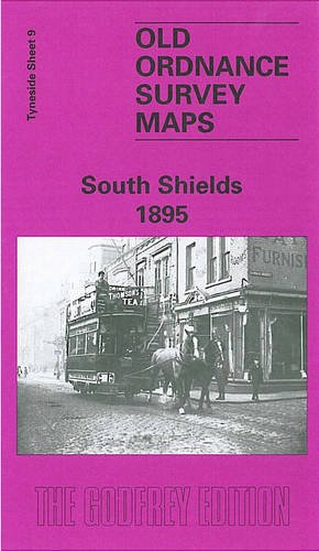

Detailed map of South Shields; Tyneside sheet 9. Introduction by Roy Young - Second Edition. One of our earliest publications, this busy map covers central South Shields from rly stn southward; incl High Shields stn, St Hilda colliery, Market Place, Laygate, many rlys, docks, tramways.
"synopsis" may belong to another edition of this title.
- PublisherAlan Godfrey Maps
- Publication date1984
- ISBN 10 0907554822
- ISBN 13 9780907554820
- BindingMap
Buy New
Learn more about this copy
US$ 6.75
Shipping:
US$ 5.60
From United Kingdom to U.S.A.
Top Search Results from the AbeBooks Marketplace
Stock Image
South Shields 1895
Published by
Alan Godfrey Maps 1984-12-01
(1984)
ISBN 10: 0907554822
ISBN 13: 9780907554820
New
Hardcover
Quantity: 1
Seller:
Rating
Book Description hardback. Condition: New. Language: ENG. Seller Inventory # 9780907554820
Buy New
US$ 6.75
Convert currency
Stock Image
South Shields 1895 Tyneside Sheet 9 Old Ordnance Survey Maps of Tyneside
Seller:
Rating
Book Description UNK. Condition: New. New Book. Shipped from UK. Established seller since 2000. Seller Inventory # GB-9780907554820
Buy New
US$ 14.25
Convert currency
Stock Image
South Shields (Old O.S. Maps of Tyneside)
Seller:
Rating
Book Description Map. Condition: Brand New. 8.03x4.41x0.16 inches. In Stock. Seller Inventory # __0907554822
Buy New
US$ 4.28
Convert currency
Stock Image
South Shields 1895: Tyneside Sheet 9 (Old Ordnance Survey Maps of Tyneside)
Seller:
Rating
Book Description Map. Condition: New. BRAND NEW ** SUPER FAST SHIPPING FROM UK WAREHOUSE ** 30 DAY MONEY BACK GUARANTEE. Seller Inventory # 9780907554820-GDR
Buy New
US$ 7.57
Convert currency
Stock Image
South Shields 1895: Tyneside Sheet 9
Seller:
Rating
Book Description Sheet map, folded. Condition: New. New copy - Usually dispatched within 4 working days. Seller Inventory # B9780907554820
Buy New
US$ 7.68
Convert currency
Stock Image
South Shields 1895: Tyneside Sheet 9 (Old Ordnance Survey Maps of Tyneside)
Seller:
Rating
Book Description Condition: New. In. Seller Inventory # ria9780907554820_new
Buy New
US$ 7.09
Convert currency
Stock Image
South Shields (Old O.S. Maps of Tyneside)
Seller:
Rating
Book Description Map. Condition: Brand New. 8.03x4.41x0.16 inches. In Stock. Seller Inventory # zk0907554822
Buy New
US$ 7.14
Convert currency
Stock Image
South Shields 1895 Tyneside Sheet 9 Old Ordnance Survey Maps of Tyneside
Seller:
Rating
Book Description UNK. Condition: New. New Book. Shipped from UK. Established seller since 2000. Seller Inventory # GB-9780907554820
Buy New
US$ 7.86
Convert currency
Seller Image
South Shields 1895 : Tyneside Sheet 9
Published by
Alan Godfrey Maps Dez 1984
(1984)
ISBN 10: 0907554822
ISBN 13: 9780907554820
New
Quantity: 4
Seller:
Rating
Book Description Karte. Condition: Neu. Neuware Deutsch. Seller Inventory # 9780907554820
Buy New
US$ 4.88
Convert currency
Stock Image
South Shields 1895: Tyneside Sheet 9
Seller:
Rating
Book Description No Binding. Condition: New. No Jacket. Here are the details of maps for South Shields: Tyneside Sheet 9a South Shields 1895 - published 1982, 2nd Ed 2008; intro by Roy Young. ISBN.978-0-907554-82-0 Tyneside Sheet 9b South Shields 1913 - published 2015; intro by Anthea Lang. ISBN.978-1-84784-909-0 We have published two versions of this busy map, showing how the area changed across the years. The maps cover the heart of South Shields, with coverage stretching from Ocean Road southward to Dean Lane, and from West Holborn eastward to Sea Road. The many features include railway with High Shields and South Shields stations, Holy Trinity church, Laygate, St Jude's church, St Hilda Colliery, St Hilda Colliery Wagonway, Mill Dam Valley, Holborn Graving Dock, St Hilda's church, landing stage, South Shields Marsden & Whitburn Colliery Railway, other mineral railways, St Michael & All Angels church, part of Westoe along Dean Lane, King Street, Market Place, tramways, Westoe Brewery, Mariners Cottages, Bent House, Westoe Lane station, Glass Works etc. This map links up with Tyneside Sheet 3 Mouth of the Tyne to the north, Tyneside Sheet 8 Percy Main to the west,and Tyneside Sheet 16 Harton to the south. Seller Inventory # 000936
Buy New
US$ 3.52
Convert currency