Liverpool (North) 1906: Lancashire Sheet 106.10 (Old O.S. Maps of Lancashire)

Buy New
Learn more about this copy
US$ 6.94
Shipping:
US$ 5.63
From United Kingdom to U.S.A.
Top Search Results from the AbeBooks Marketplace
Stock Image
Liverpool (North) 1906
Published by
Alan Godfrey Maps 1990-02-01
(1990)
ISBN 10: 0850542952
ISBN 13: 9780850542950
New
Hardcover
Quantity: 1
Seller:
Rating
Book Description hardback. Condition: New. Language: ENG. Seller Inventory # 9780850542950
Buy New
US$ 6.94
Convert currency
Stock Image
Liverpool North 1906 Lancashire Sheet 10610 Old OS Maps of Lancashire
Seller:
Rating
Book Description PAP. Condition: New. New Book. Shipped from UK. Established seller since 2000. Seller Inventory # GB-9780850542950
Buy New
US$ 14.14
Convert currency
Stock Image
North Liverpool
Seller:
Rating
Book Description Map. Condition: Brand New. facsimile of 1906 ed edition. 8.46x4.88x0.16 inches. In Stock. Seller Inventory # __0850542952
Buy New
US$ 4.30
Convert currency
Stock Image
Liverpool (North) 1906: Lancashire Sheet 106.10 (Old O.S. Maps of Lancashire)
Seller:
Rating
Book Description Map. Condition: New. BRAND NEW ** SUPER FAST SHIPPING FROM UK WAREHOUSE ** 30 DAY MONEY BACK GUARANTEE. Seller Inventory # 9780850542950-GDR
Buy New
US$ 7.60
Convert currency
Stock Image
Liverpool (North) 1906: Lancashire Sheet 106.10
Seller:
Rating
Book Description Sheet map, folded. Condition: New. New copy - Usually dispatched within 4 working days. Seller Inventory # B9780850542950
Buy New
US$ 7.71
Convert currency
Stock Image
Liverpool (North) 1906: Lancashire Sheet 106.10 (Old O.S. Maps of Lancashire)
Seller:
Rating
Book Description Condition: New. In. Seller Inventory # ria9780850542950_new
Buy New
US$ 7.11
Convert currency
Stock Image
Liverpool North 1906 Lancashire Sheet 10610 Old OS Maps of Lancashire
Seller:
Rating
Book Description PAP. Condition: New. New Book. Shipped from UK. Established seller since 2000. Seller Inventory # GB-9780850542950
Buy New
US$ 7.89
Convert currency
Seller Image
Liverpool (North) 1906 : Lancashire Sheet 106.10
Published by
Alan Godfrey Maps Feb 1990
(1990)
ISBN 10: 0850542952
ISBN 13: 9780850542950
New
Quantity: 4
Seller:
Rating
Book Description Karte. Condition: Neu. Neuware Deutsch. Seller Inventory # 9780850542950
Buy New
US$ 4.90
Convert currency
Stock Image
Liverpool (North) 1906: Lancashire Sheet 106.10 (Old O.S. Maps of Lancashire)
Seller:
Rating
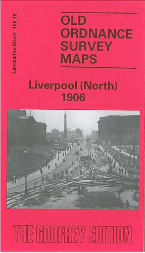
Book Description No Binding. Condition: New. No Jacket. Here are the details of maps for Liverpool (North): Lancs Sheet 106.10a Liverpool (North) 1890 - published 2015; intro by Kay Parrott. ISBN.978-1-84784-923-6 Lancs Sheet 106.10b Liverpool (North) 1906 - published 1990; intro by Naomi Evetts. ISBN.978-0-85054-295-0 We have published two versions of this map, showing how the area changed across the years. The 1890 version is in colour, taken from the beautiful 1st Edition OS handcoloured map. These detailed maps are double-sided to provide maximum coverage. The main map, 106.10, covers a major northern part of the city, with coverage stretching from King Edward Street eastward to Everton Road, and from Conway Street southward to William Brown Street. This is a very busy map, but features include Walker Art Gallery, Library & Museum, Tobacco Manufactory, Wholesale Fruit Market, Victoria Square, St Anthony's RC church, tramways, St Augustine's church, Rupert Lane Barracks, Liverpool College, western part of Everton, St Anne's Ward, South Scotland Ward, Vauxhall Ward, LYR railway with Exchange station, Exchange Station Junction, Great Howard St Goods Station, LNWR Waterloo Goods Station with tunnel shown, David Lewis Northern Hospital, Leeds & Liverpool Canal etc. On the reverse we include adjacent sheet 106.09 extending coverage westward to the docks, incl Nelson Dock, Collingwood Dock, Salisbury Dock, Clarence Dock, Trafalgar Dock, Victoria Dock, Waterloo Docks, part of Prince's Dock, with part of Riverside Railway and Overhead Railway. Street directory entries for Everton Brow, Great Homer Street and Great Howard Street are also included. This map links up with sheet 106.06 Kirkdale to the north, 106.11 Newsham Park to the east, 106.14 Central Liverpool to the south. Seller Inventory # 000732
Buy New
US$ 3.29
Convert currency
Seller Image
Evetts, N: Liverpool (North) 1906
Seller:
Rating
Book Description Condition: New. Seller Inventory # 595094398
Buy New
US$ 11.65
Convert currency