
Order Total (1 Item Items):
Shipping Destination:

Wakefield 1905 Yorkshire Sheet by Alan Godfrey (10 results)
Skip to main search results
Product Type
- All Product Types
- Books (6)
- Magazines & Periodicals
- Comics
- Sheet Music
- Art, Prints & Posters
- Photographs
- Maps (4)
-
Manuscripts &
Paper Collectibles
Condition
- All Conditions
- New
- Used
Binding
- All Bindings
- Hardcover
- Softcover
Collectible Attributes
- First Edition
- Signed
- Dust Jacket
- Seller-Supplied Images (1)
- Not Printed On Demand
Free Shipping
Seller Location
Seller Rating
-
Wakefield West 1905 Yorkshire Sheet 24806 Old Ordnance Survey Maps of Yorkshire
Published by Alan Godfrey Maps, 2012
ISBN 10: 1847845665ISBN 13: 9781847845665
Book
UNK. Condition: New. New Book. Shipped from UK. Established seller since 2000.
-
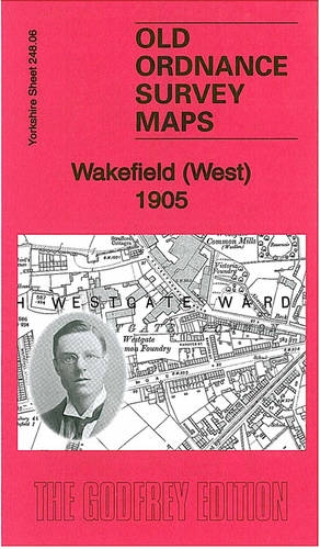
Wakefield (West) 1905: Yorkshire Sheet 248.06 (Old Ordnance Survey Maps of Yorkshire)
Published by Alan Godfrey Maps, 2012
ISBN 10: 1847845665ISBN 13: 9781847845665
Map
Map. Condition: Brand New. 8.39x4.80x0.12 inches. In Stock.
-
Wakefield (West) 1905: Yorkshire Sheet 248.06
Published by Alan Godfrey Maps, 1619
ISBN 10: 1847845665ISBN 13: 9781847845665
Book
Sheet map, folded. Condition: New. New copy - Usually dispatched within 4 working days.
-
Wakefield (West) 1905: Yorkshire Sheet 248.06 (Old Ordnance Survey Maps of Yorkshire)
Published by Alan Godfrey Maps, 2012
ISBN 10: 1847845665ISBN 13: 9781847845665
Book
Map. Condition: New. BRAND NEW ** SUPER FAST SHIPPING FROM UK WAREHOUSE ** 30 DAY MONEY BACK GUARANTEE.
-
Wakefield (West) 1905: Yorkshire Sheet 248.06 (Old Ordnance Survey Maps of Yorkshire)
Published by GARDNERS VI BOOKS AMS006, 1619
ISBN 10: 1847845665ISBN 13: 9781847845665
Book
Condition: New. In.
-
Wakefield (West) 1905: Yorkshire Sheet 248.06 (Old Ordnance Survey Maps of Yorkshire)
Published by Alan Godfrey Maps, 2012
ISBN 10: 1847845665ISBN 13: 9781847845665
Map
Map. Condition: Brand New. 8.39x4.80x0.12 inches. In Stock.
-
Wakefield West 1905 Yorkshire Sheet 24806 Old Ordnance Survey Maps of Yorkshire
Published by Alan Godfrey Maps, 2012
ISBN 10: 1847845665ISBN 13: 9781847845665
Book
UNK. Condition: New. New Book. Shipped from UK. Established seller since 2000.
-
Wakefield (West) 1905 : Yorkshire Sheet 248.06
Published by Alan Godfrey Maps Feb 2012, 2012
ISBN 10: 1847845665ISBN 13: 9781847845665
Book
Karte. Condition: Neu. Neuware Deutsch.
-
Wakefield (West) 1905: Yorkshire Sheet 248.06 (Old Ordnance Survey Maps of Yorkshire)
Published by Alan Godfrey Maps, 2012
ISBN 10: 1847845665ISBN 13: 9781847845665
Map
No Binding. Condition: New. No Jacket. Here are the details of the map for Wakefield (West): Yorkshire Sheet 248.06 Wakefield (West) 1905 - published 2012; intro by Alan Godfrey. ISBN.978-1-84784-566-5 This detailed map covers the western edge of Wakefield, with coverage stretching from Thornes Park and Westgate Common westward to Roundwood Colliery. Features include tramway, Westgate Common Mills, St Michael's church, Thornes House (at eastern margin), Lupset Hall (on southern margin), Whinney Moor Colliery, Manor Haigh Moor Colliery, Westgate Colliery & Brickworks, Flanshaw Hall, Snapethorpe Hall, Roundwood Colliery. On the reverse we include an extract from the 1933 edition showing the Dewsbury Road area at a later stage, when part of the Lupset estate had been built. The map links up with sheets 248.02 Alverthorpe to the north, 248.05 Ossett to the west, 248.07 Wakefield South to the east.