Order Total (1 Item Items):
Shipping Destination:

South East Central England (23 results)
Skip to main search results
Product Type
- All Product Types
- Books (20)
- Magazines & Periodicals
- Comics
- Sheet Music
- Art, Prints & Posters
- Photographs
- Maps (3)
-
Manuscripts &
Paper Collectibles
Condition
Binding
Collectible Attributes
- First Edition (3)
- Signed
- Dust Jacket (1)
- Seller-Supplied Images (7)
- Not Printed On Demand
Free Shipping
Seller Location
Seller Rating
-
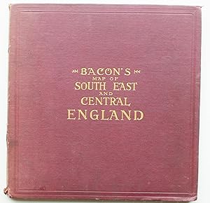
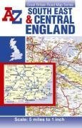
A-Z South-East and Central England
Published by Geographers' A-Z Map Company, 2003
ISBN 10: 1843480441ISBN 13: 9781843480440
Book
Condition: Very Good. 1694003111. 9/6/2023 12:25:11 PM.
More buying choices from other sellers on AbeBooks
New offers from US$ 114.65
Used offers from US$ 4.35
Also find Softcover
-
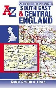
South East and Central England Road Map
Published by Geographers? A-Z Co., Ltd., 2006
ISBN 10: 184348367XISBN 13: 9781843483670
Book
Befriedigend/Good: Durchschnittlich erhaltenes Buch bzw. Schutzumschlag mit Gebrauchsspuren, aber vollst�ndigen Seiten. / Describes the average WORN book or dust jacket that has all the pages present.
-

South East & Central England Road Map
Published by Geographers A-Z Map Company, 2010
ISBN 10: 1843487039ISBN 13: 9781843487036
Book
Paperback. Condition: Very Good. The book has been read, but is in excellent condition. Pages are intact and not marred by notes or highlighting. The spine remains undamaged.
-

An excursion guide to the geology of central South West England: report on the field meeting to West Devon and East Cornwall May 1982 - Geology of
Published by Academic Journal Offprint from: - Proc. Geologists Assoc. 94 (Part 4), 1983., 1983
20pp, 3figs, Printed Card Cover, VGC,
-
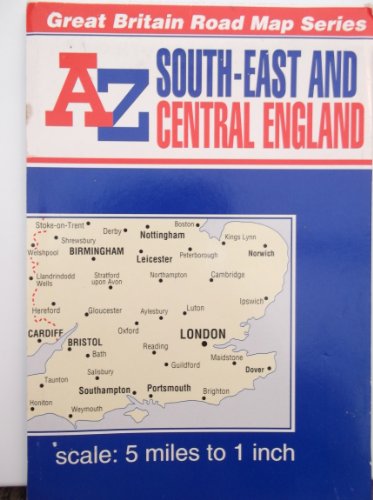
A Z Great Britain Road Series South-East and Central England
Published by Geographers' A-Z Map Company Ltd, London, 1999
ISBN 10: 0850391180ISBN 13: 9780850391183
Book
Brief/Blatt/Landkarte. Condition: leichte Gebrauchsspuren. 27th Edition. READY TO SEND! Good condition only the binding is scuffed In englischer Sprache. 1 : 316,800.
More buying choices from other sellers on AbeBooks
Used offers from US$ 8.83
-
![Stock image for SOUTH EAST AND CENTRAL ENGLAND A-Z ROAD MAP [New edition] for sale by WorldofBooks](https://pictures.abebooks.com/isbn/9781782570264-us-300.jpg)
SOUTH EAST AND CENTRAL ENGLAND A-Z ROAD MAP [New edition]
Published by Geographers? A-Z Map Co Ltd, 2014
ISBN 10: 1782570268ISBN 13: 9781782570264
Book
Paperback. Condition: Good. The book has been read but remains in clean condition. All pages are intact and the cover is intact. Some minor wear to the spine.
-

South East and Central England Road Map
Published by Geographers' A-Z Map Co Ltd, 2000
ISBN 10: 0850396905ISBN 13: 9780850396904
Book
Paperback. Condition: Good. Clean copy, sound binding. Quick dispatch from UK seller.
-
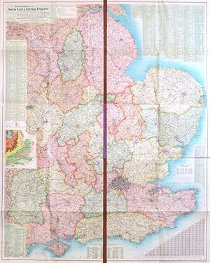
Hardcover. Condition: Good. Burgundy cloth-covered boards, gilt titles on front and spine. Bumped extremities. Air bubbles to cloth on front board. 4to. Boards open out to reveal two halves of the colour map, each having 10 panels, divided into squares, showing 10 miles on each. Maps are printed on linen and in very good condition, with just a little miss-folding to edges. Maps also show a Gazetteer and speed limits for various vehicles.
-
Richardson's Map of South East & Central England. Comprising the Counties of Derby, Nottingham, Lincoln, Leicester, Rutland, Warwick, Northampton, Huntingdon, Cambridge, Norfolk, Suffolk, Bedford, Oxford, Buckingham, Hertford, Essex, Middlesex, London, Berkshire, Wiltshire, Hampshire, Surrey, Sussex & Kent. Showing Boroughs in Separate Colours, Railways, Roads, & Golf Links
Published by [Manchester]: G.W. Bacon [1920s]., 1920
Seller: Bow Windows Bookshop (ABA, ILAB), Lewes, United Kingdom
Association Member: ABA ILAB PBFA
Seller Rating:

Folding colour printed map in two parts each measuring 48 x 123 cm, i.e. 96 x 123 if joined, both sides backed onto linen and folding between publisher's purple cloth boards, gilt lettered to the upper cover. Originally published by the firm Frank S. Richardson, also of Manchester.
-
![Seller image for Folio 23 [The coast of south central England. Dorset, southern Hampshire & Somerset, and east Devon. The Jurassic Coast, the Solent and the Isle of Wight] for sale by Antiqua Print Gallery](https://pictures.abebooks.com/inventory/md/md31621786328.jpg)
Folio 23 [The coast of south central England. Dorset, southern Hampshire & Somerset, and east Devon. The Jurassic Coast, the Solent and the Isle of Wight]
Publication Date: 1922
Map
Condition: Good. Southern England. Jurassic Coast Dorset Hampshire Devon ORDNANCE SURVEY 1922 map. Antique linen-backed survey atlas map; Ordnance Survey (1922). 31.0 x 73.0cm, 12 x 28.75 inches; this is a folding map. Condition: Good. There is nothing printed on the reverse side, which is plain.
-
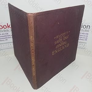
Bacon's Map Of South East & Central England
Published by Manchester: G W Bacon & Co Ltd no date c ?, 1912
First Edition
Light rubbing and marking to cloth cover. [1912]. First Edition. Maroon hardback cloth cover. 10" x 10". 12 panel linen-backed colour map. Pre First World War map of the South East and Central England. Includes mileage limitations for cars which are set at 10 mph. .
-
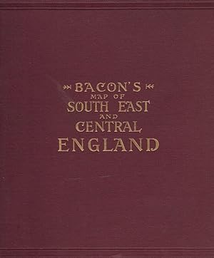
Bacon's Map of South East and Central England
Published by G W Bacon & Co Ltd [1912], Manchester, 1912
Map First Edition
Maroon hardback cloth cover. First Edition. 250mm x 250mm (10" x 10"). 20 panels. 20 panel linen-backed colour map. Pre First World War map of the South East and Central England. Includes mileage limitations for cars which are set at c. 10 mph. VG : in very good condition. Light rubbing and marking to cloth cover.
-

JEWISH ART AND CIVILIZATION:Two (2) Volume Set/Vol. 1:Ancient Near East, Byzantium, Muslim Lands, Spain/Portugal/Conversos, Italy, France, Germany; Vol. 2:England, Netherlands, Poland/Russia, United States of America, South/Central America, Israel Today
Published by Walker & Company, New York, 1972
ISBN 10: 0802703941ISBN 13: 9780802703941
Book First Edition
Hardcover. Condition: Very Good+. Dust Jacket Condition: Very Good+. First Edition. Original blue cloth covers w/ gilt title on spine. Very bright and clean. Spine ends slightly bumped. Illust. w/ over 400 color and b/w photos. Contents very nice.
-
Hardcover. Condition: Good. Large folding map divided into two sections. Red cloth boards with gilt titles to front. Covers generally rubbed and spine sunned, frayed and a little weak. Map divided into two and with each part attached to different boards. Mounted on linen, not sectionalised, and consequently a little wear to folds. Slight wear to margins. Speed limits table for cars. Small inset geological map. Population table. Full colour. Railways still shown as 'ladder' style. Some hachuring of landscape. Area covered includes the Humber estuary to the north and I.O.W. to the south. Each sheet 48cm by 122cm approx. Note: photos show the sheets only partly open. Dated uncertain but style suggests around 1914. Mre details available on request. (non379bxij).
-

Jewish Art and Civilization. 2 Volumes. Vol. 1: Ancient Near East. Byzantium. Muslim Lands. Spain, Portugal and the Conversos. Italy. France. Germany. Vol. 2: England. Netherlands. Poland and Russia. United States of America. South and Central America. Israel Today.
Published by Office du Livre, Fribourg,, 1972
editor's binding with jacket. 305x255mm, 290 + 266pages, Illustrated with ower 400 color and black-and-white photographs, Exemplar as new. En cas de probl�me de commande, veuillez nous contacter via notre page d'accueil / If there is a problem with the order, please contact us via our homepage.