
Order Total (1 Item Items):
Shipping Destination:

Rothbury Forest 1866 73 by Robert Forsythe (2 results)
Skip to main search results
Product Type
- All Product Types
- Books (1)
- Magazines & Periodicals
- Comics
- Sheet Music
- Art, Prints & Posters
- Photographs
- Maps (1)
- Manuscripts & Paper Collectibles
Condition
Binding
- All Bindings
- Hardcover
- Softcover (1)
Collectible Attributes
- First Edition
- Signed
- Dust Jacket
- Seller-Supplied Images
- Not Print on Demand (2)
Free Shipping
- Free US Shipping
Seller Location
Seller Rating
-
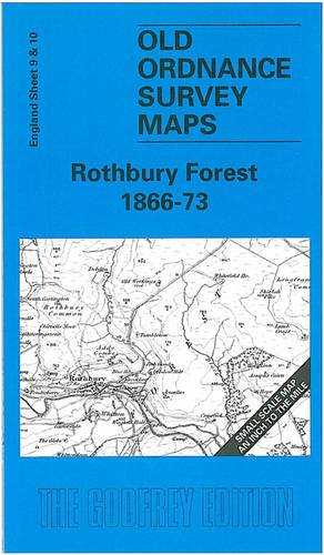
Rothbury Forest 1866-73 (Old Ordnance Survey Maps - Inch to the Mile)
Published by Alan Godfrey Maps, 1999
ISBN 10: 1841510343ISBN 13: 9781841510347
Book
Paperback. Condition: Very Good. The book has been read, but is in excellent condition. Pages are intact and not marred by notes or highlighting. The spine remains undamaged.
-
Rothbury Forest 1866-73 (Old Ordnance Survey Maps - Inch to the Mile)
Published by Alan Godfrey Maps, 1999
ISBN 10: 1841510343ISBN 13: 9781841510347
Map
No Binding. Condition: New. No Jacket. Here is information about Sheet 9 & 10: One Inch Sheet 9/10 Rothbury Forest 1866-73 - published 1999; intro by Robert Forsythe. ISBN.978-1-84151-034-7 This map, which includes sheets 9 and 10 side by side, covers the area of Northumberland from Rothbury eastward to Amble, and southward to Newbiggin. Features include Coquet Valley, Coquet Island, Druridge Bay, the Northumberland Central Railway to Rothbury, the Amble Branch, and the Blyth & Tyne Railway to Newbiggin. On the reverse is a detailed map of Widdrington village. It is not possible to list the many hamlets, farmsteads and other topographical features shown on these maps. However, you may find it useful if we list the towns and principal villages or parishes that are included on this map: Northumberland: Acklington, Amble, Bothal, Brinkburn, Ellington, Felton, Guizance, Longhirst, Longhorsley, Netherwitton, Newbiggin, Rothbury, Rothley stn, Thropton, Tritlington, Ulgham, Widdrington, Woodhorn.