
Order Total (1 Item Items):
Shipping Destination:

Liverpool 1848 Sheet by Parrott Kay (16 results)
Skip to main search results
Product Type
- All Product Types
- Books (10)
- Magazines & Periodicals
- Comics
- Sheet Music
- Art, Prints & Posters
- Photographs
- Maps (6)
-
Manuscripts &
Paper Collectibles
Condition
Binding
- All Bindings
- Hardcover
- Softcover (1)
Collectible Attributes
- First Edition
- Signed
- Dust Jacket
- Seller-Supplied Images (2)
- Not Printed On Demand
Free Shipping
Seller Location
Seller Rating
-
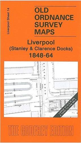
Liverpool (Stanley and Clarence Docks) 1848-64: Liverpool Sheet 14 (Old Ordnance Survey Maps - Yard to the Mile)
Published by Alan Godfrey Maps, 1648
ISBN 10: 1847842860ISBN 13: 9781847842862
Book
Paperback. Condition: Very Good. The book has been read, but is in excellent condition. Pages are intact and not marred by notes or highlighting. The spine remains undamaged.
-

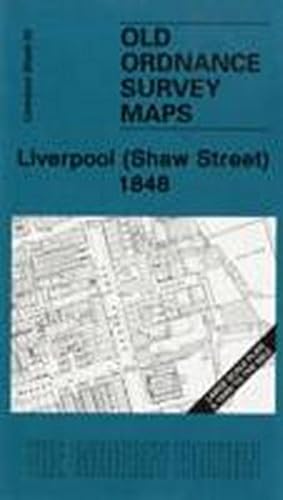
Liverpool (Shaw Street) 1848: Liverpool Sheet 20
Published by Alan Godfrey Maps, 2008
ISBN 10: 1847841090ISBN 13: 9781847841094
Map
Map. Condition: Brand New. 8.27x4.49x0.16 inches. In Stock.
-
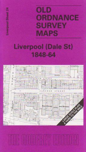
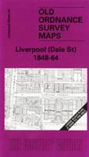
Liverpool (Dale Street) 1848-64: Liverpool Sheet 24 (Old O.S. Maps of Liverpool)
Published by Alan Godfrey Maps, 2004
ISBN 10: 1841516597ISBN 13: 9781841516592
Book
Map. Condition: New. BRAND NEW ** SUPER FAST SHIPPING FROM UK WAREHOUSE ** 30 DAY MONEY BACK GUARANTEE.
-
Liverpool (Shaw Street) 1848: Liverpool Sheet 20 (Old Ordnance Survey Maps - Yard to the Mile)
Published by Alan Godfrey Maps, 2008
ISBN 10: 1847841090ISBN 13: 9781847841094
Book
Map. Condition: New. BRAND NEW ** SUPER FAST SHIPPING FROM UK WAREHOUSE ** 30 DAY MONEY BACK GUARANTEE.
-
Liverpool (Dale Street) 1848-64: Liverpool Sheet 24
Published by Alan Godfrey Maps, 2004
ISBN 10: 1841516597ISBN 13: 9781841516592
Book
Sheet map, folded. Condition: New. New copy - Usually dispatched within 4 working days.
-
Liverpool (Shaw Street) 1848: Liverpool Sheet 20
Published by Alan Godfrey Maps
ISBN 10: 1847841090ISBN 13: 9781847841094
Book
Sheet map, folded. Condition: New. New copy - Usually dispatched within 4 working days.
-
Liverpool (Dale Street) 1848-64: Liverpool Sheet 24 (Old O.S. Maps of Liverpool)
Published by Alan Godfrey Maps, 2004
ISBN 10: 1841516597ISBN 13: 9781841516592
Book
Condition: New. In.
-
Liverpool (Shaw Street) 1848: Liverpool Sheet 20
Published by Alan Godfrey Maps, 2008
ISBN 10: 1847841090ISBN 13: 9781847841094
Map
Map. Condition: Brand New. 8.27x4.49x0.16 inches. In Stock.
-
Liverpool Shaw Street 1848 Liverpool Sheet 20 Old Ordnance Survey Maps Yard to the Mile
Published by Alan Godfrey Maps, 2008
ISBN 10: 1847841090ISBN 13: 9781847841094
Book
UNK. Condition: New. New Book. Shipped from UK. Established seller since 2000.
-
Liverpool (Shaw Street) 1848 : Liverpool Sheet 20
Published by Alan Godfrey Maps Feb 2008, 2008
ISBN 10: 1847841090ISBN 13: 9781847841094
Book
Karte. Condition: Neu. Neuware Deutsch.
-
Liverpool (Dale Street) 1848-64 : Liverpool Sheet 24
Published by Alan Godfrey Maps Jun 2004, 2004
ISBN 10: 1841516597ISBN 13: 9781841516592
Book
Karte. Condition: Neu. Neuware Deutsch.
-
Liverpool Shaw Street 1848 Liverpool Sheet 20 Old Ordnance Survey Maps Yard to the Mile
Published by Alan Godfrey Maps, 2008
ISBN 10: 1847841090ISBN 13: 9781847841094
Book
PAP. Condition: New. New Book. Shipped from UK. Established seller since 2000.
-
Liverpool (Dale Street) 1848-64: Liverpool Sheet 24
Published by Alan Godfrey Maps, 2004
ISBN 10: 1841516597ISBN 13: 9781841516592
Map
No Binding. Condition: New. No Jacket. Here are the details of maps for Liverpool Dale Street: Liverpool Sheet 24 Liverpool (Dale Street) 1848-64 - published 2004; intro by Kay Parrott. ISBN.978-1-84151-659-2 This wonderfully detailed map covers the area of Liverpool around Dale Street. Coverage stretches from Old Hall Street eastward to St George's Hall, and from Great Cross Hall Street southward to Williamson Square. The many features include The Royal Exchange, Town Hall, Exchange Station, St Paul's church, Theatre Royal, St John's church, St George's Hall, St John's Market, Library and Museum, Royal Amphitheatre all shown in great detail.There are also crowded streets off Dale Street, Whitechapel, Queen's Square, Old Hay Market, Tithe Barn Street etc. On the reverse we include street directory entries, including Dale Street, Great Charlotte St, Great Crosshall St, Highfield St, Manchester St, Queen Square, Whitechapel. The map links up with Liverpool Sheets 19 Liverpool Vauxhall to the north, 23 Liverpool Pierhead to the west, 25 Liverpool London Rd to the east and 29 Liverpool Hanover St to the south.
-
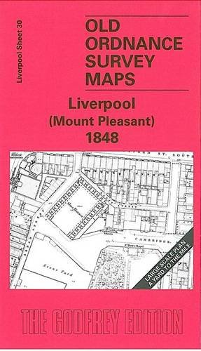
Liverpool (Mount Pleasant) 1848: Liverpool Sheet 30
Published by Alan Godfrey Maps, 2005
ISBN 10: 1841518115ISBN 13: 9781841518114
Map
No Binding. Condition: New. No Jacket. Here are the details of maps for Liverpool Mount Pleasant: Liverpool Sheet 30 Liverpool (Mount Pleasant) 1848 - published 2005; intro by Kay Parrott. ISBN.978-1-84151-811-4 This wonderfully detailed map covers the area of Liverpool around Mount Pleasant. Coverage stretches from Bold Street and Wood Street eastward to Abercromby Square, and from Brownlow Hill southward to Hope Place. The many features include Parish Workhouse, St Mary's Cemetery, fever hospital, St Philip's church, Rodney St Presbyterian Chapel, St Luke's church, Royal Institution, Ranelagh Place, Adelphi Hotel, and the many streets, courts, passages and even gardens in the adjacent area. We include a selection of street directory entries on the reverse, including Bedford Street, Brownlow Hill, Mount Pleasant, Mulberry Street, Renshaw Street, Rodney Street, Seel Street. The map links up with Liverpool Sheets 25 Liverpool London Road to the north, 29 Hanover Street to the west and 35 Liverpool St James' Mount to the south.
-
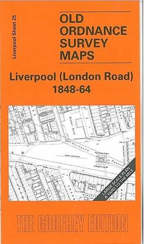
Liverpool (London Road) 1848-64: Liverpool Sheet 25
Published by Alan Godfrey Maps, 2005
ISBN 10: 1841517380ISBN 13: 9781841517384
Map
No Binding. Condition: New. No Jacket. Here are the details of maps for Liverpool London Road: Liverpool Sheet 25 Liverpool (London Road) 1848-64 - published 2005; intro by Kay Parrott. ISBN.978-1-84151-738-4 This wonderfully detailed map covers the area of Liverpool around London Road. Coverage stretches from Lime Street station eastward to Elizabeth Street, and from Islington southward to Warren Street and part of Brownlow Hill. Features include Lime Street station , Schools for the Indigent Blind, Infirmary, St Jude's church, Lunatic Hospital, Lock Hospital, Monument Place, St Nicholas RC Chapel, and the many streets, alleys and courts off Seymour Street, Russell Street, London Road, Pembroke Place etc. On the reverse we include a selection of street directory entries, incl Clare Street, Copperas Hill, Dansie Street, Elizabeth Street, Epworth Street, Finch Street, Great Newton Street, Hardwick Street, London Road, Norton Street, Pembroke Place. The map links up with Liverpool Sheets 20 Liverpool Shaw St to the north, 24 Liverpool Dale St to the west, 30 Mount Pleasant to the south.
-
Liverpool (Shaw Street) 1848: Liverpool Sheet 20
Published by Alan Godfrey Maps, 2008
ISBN 10: 1847841090ISBN 13: 9781847841094
Map
No Binding. Condition: New. No Jacket. Here are the details of maps for Liverpool Shaw Street: Liverpool Sheet 20 Liverpool (Shaw Street) 1848 - published 2008; intro by Kay Parrott. ISBN.978-1-84784-109-4 This wonderfully detailed map covers the area of Liverpool around Soho Street, Shaw Street and St Anne Street. Other streets covered include Richmond Row, Everton Crescent, Fox Street, Springfield, Canterbury Street. Features include Trinity church, St Ann's church, Liverpool Collegiate Institution, St Augustine's church, Pleasure Grounds and several streets of cramped housing. A very detailed portrait, though of a small area; coverage stretches from Christian Street eastward to Guildford Street, and from Everton Brow southward to Carver Street. The map links up with Liverpool Sheets 19 Vauxhall to the west, 25 London Road to the south.