
Order Total (1 Item Items):
Shipping Destination:

9781841512013 - Wellingborough, Rushden and District 1897: One Inch Map 186 Old Ordnance Survey Maps of England & Wales by Trinder, Barrie (11 results)
Skip to main search results
Product Type
- All Product Types
- Books (9)
- Magazines & Periodicals
- Comics
- Sheet Music
- Art, Prints & Posters
- Photographs
- Maps (2)
-
Manuscripts &
Paper Collectibles
Condition
- All Conditions
- New
- Used
Binding
- All Bindings
- Hardcover
- Softcover
Collectible Attributes
- First Edition
- Signed
- Dust Jacket
- Seller-Supplied Images (2)
- Not Printed On Demand
Free Shipping
Seller Location
Seller Rating
-
Wellingborough, Rushden and District 1897 One Inch Map 186 Old Ordnance Survey Maps of England Wales
Published by Alan Godfrey Maps, 2000
ISBN 10: 184151201XISBN 13: 9781841512013
Book
UNK. Condition: New. New Book. Shipped from UK. Established seller since 2000.
-
Wellingborough, Rushden And District 1897
Published by Alan Godfrey Maps, 2000
ISBN 10: 184151201XISBN 13: 9781841512013
Map
Map. Condition: Brand New. 8.31x4.76x0.04 inches. In Stock.
-
Wellingborough, Rushden and District 1897: One Inch Map 186
Published by Alan Godfrey Maps, 2000
ISBN 10: 184151201XISBN 13: 9781841512013
Book
Sheet map, folded. Condition: New. New copy - Usually dispatched within 4 working days.
-
Wellingborough, Rushden and District 1897: One Inch Map 186 (Old Ordnance Survey Maps of England & Wales)
Published by Alan Godfrey Maps, 2000
ISBN 10: 184151201XISBN 13: 9781841512013
Book
Map. Condition: New. BRAND NEW ** SUPER FAST SHIPPING FROM UK WAREHOUSE ** 30 DAY MONEY BACK GUARANTEE.
-
Wellingborough, Rushden and District 1897: One Inch Map 186 (Old Ordnance Survey Maps of England & Wales)
Published by Alan Godfrey Maps, 2000
ISBN 10: 184151201XISBN 13: 9781841512013
Book
Condition: New. In.
-
Wellingborough, Rushden and District 1897 (Old Ordnance Survey Maps)
Published by The Godfrey Edition, 2000
ISBN 10: 184151201XISBN 13: 9781841512013
Book
Condition: New. 2000. Map. Series: Old Ordnance Survey Maps of England & Wales. BIC Classification: 1DBKEMM; 3JH; WQH; WTRM. Category: (G) General (US: Trade). Dimension: 112 x 214 x 2. Weight in Grams: 24. One Inch Map 186. Series: Old Ordnance Survey Maps of England & Wales. Cateogry: (G) General (US: Trade). BIC Classification: 1DBKEMM; 3JH; WQH; WTRM. Dimension: 112 x 214 x 2. Weight: 26. . . . . . Books ship from the US and Ireland.
-
Wellingborough, Rushden and District 1897 (Old Ordnance Survey Maps)
Published by The Godfrey Edition, 2000
ISBN 10: 184151201XISBN 13: 9781841512013
Book
Condition: New. 2000. Map. Series: Old Ordnance Survey Maps of England & Wales. BIC Classification: 1DBKEMM; 3JH; WQH; WTRM. Category: (G) General (US: Trade). Dimension: 112 x 214 x 2. Weight in Grams: 24. One Inch Map 186. Series: Old Ordnance Survey Maps of England & Wales. Cateogry: (G) General (US: Trade). BIC Classification: 1DBKEMM; 3JH; WQH; WTRM. Dimension: 112 x 214 x 2. Weight: 26. . . . . .
-

Wellingborough, Rushden and District 1897 : One Inch Map 186
Published by Alan Godfrey Maps Sep 2000, 2000
ISBN 10: 184151201XISBN 13: 9781841512013
Book
Karte. Condition: Neu. Neuware Deutsch.
-
Wellingborough, Rushden and District 1897 One Inch Map 186 Old Ordnance Survey Maps of England Wales
Published by Alan Godfrey Maps, 2000
ISBN 10: 184151201XISBN 13: 9781841512013
Book
UNK. Condition: New. New Book. Shipped from UK. Established seller since 2000.
-
Wellingborough, Rushden and District 1897: One Inch Map 186 (Old Ordnance Survey Maps of England & Wales)
Published by Alan Godfrey Maps, 2000
ISBN 10: 184151201XISBN 13: 9781841512013
Map
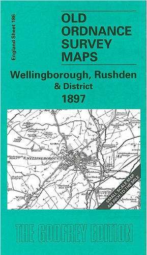
No Binding. Condition: New. No Jacket. Here is information about Sheet 186: One Inch Sheet 186 Wellingborough, Rushden & District 1897 - published 2000; intro by Barrie Trinder. ISBN.978-1-84151-201-3 This One Inch to the Mile map portrays an area of east Northamptonshire and north Bedfordshire, centred on Higham Ferrers. Wellingborough is the principal town on the map but interestingly the OS give town status to Higham Ferrers and - further east - Kimbolton, but not to Rushden. Coverage of the map stretches from Cogenhoe eastward to Kimbolton, and from Woodford and Denford southward to Castle Ashby. Railways, apart from the Midland line, include the Northampton & Peterborough Branch and Kettering & Huntingdon Branch. There is plentiful evidence of iron ore extraction. On the reverse we include a map of Finedon, with a commercial directory. It is not possible to list the many hamlets, farmsteads and other topographical features shown on these maps. However, you may find it useful if we list the towns and principal villages or church parishes that are included on this map. Links are given for those for which detailed large-scale maps are also available. Bedfordshire: Bletsoe, Bolnhurst, Colmworth, Felmersham, Keysoe, Knotting, Little Staughton, Melchbourne, Odell, Pertenhall, Podington, Riseley, Sharnbrook, Shelton, Souldrop, Swineshead, Thurleigh, Upper Dean, Wymington, Yelden. Huntingdonshire: Brington, Bythorn, Catworth, Covington, Kimbolton, Leighton Bromswold, Long Stow, Molesworth, Tilbrook. Northamptonshire: Bozeat, Broughton, Burton Latimer, Castle Ashby, Chelveston, Cogenhoe, Cranford St John, Denford, Denton, Earls Barton, Easton Maudit, Ecton, Finedon, Great Addington, Great Doddington, Great Harrowden, Grendon, Hardwick, Higham Ferrers, Irchester, Irthlingborough, Isham, Little Addington, Little Harrowden, Mears Ashby, Newton Bromswold, Orlingbury, Pytchley, Raunds, Ringstead, Rushden, Stanwick, Strixton, Wellingborough, Whiston, Wilby, Wollaston, Woodford.
-

Trinder, B: Wellingborough, Rushden and District 1897
Published by Alan Godfrey Maps, 2000
ISBN 10: 184151201XISBN 13: 9781841512013
Book
Condition: New.