
Order Total (1 Item Items):
Shipping Destination:

9780850542349 - Toxteth 1906: Lancashire Sheet 113 02 Old O S Maps of Lancashire by Evetts, Naomi (13 results)
Skip to main search results
Product Type
- All Product Types
- Books (11)
- Magazines & Periodicals
- Comics
- Sheet Music
- Art, Prints & Posters
- Photographs
- Maps (2)
- Manuscripts & Paper Collectibles
Condition
- All Conditions
- New (13)
- Used
Binding
- All Bindings
- Hardcover (1)
- Softcover
Collectible Attributes
- First Edition
- Signed
- Dust Jacket
- Seller-Supplied Images (3)
- Not Print on Demand (13)
Free Shipping
Seller Location
Seller Rating
-
Toxteth 1908
Published by Alan Godfrey Maps 1989-06-01, 1989
ISBN 10: 0850542340ISBN 13: 9780850542349
Book
hardback. Condition: New. Language: ENG.
-
Toxteth (Old O.S. Maps of Lancashire)
Published by Alan Godfrey Maps, 1989
ISBN 10: 0850542340ISBN 13: 9780850542349
Map
Map. Condition: Brand New. 8.27x4.72x0.24 inches. In Stock.
-
Toxteth 1906: Lancashire Sheet 113.02 (Old O.S. Maps of Lancashire)
Published by Alan Godfrey Maps, 1989
ISBN 10: 0850542340ISBN 13: 9780850542349
Book
Map. Condition: New. BRAND NEW ** SUPER FAST SHIPPING FROM UK WAREHOUSE ** 30 DAY MONEY BACK GUARANTEE.
-
Toxteth 1906: Lancashire Sheet 113.02
Published by Alan Godfrey Maps, 1989
ISBN 10: 0850542340ISBN 13: 9780850542349
Book
Sheet map, folded. Condition: New. New copy - Usually dispatched within 4 working days.
-
Toxteth 1906: Lancashire Sheet 113.02 (Old O.S. Maps of Lancashire)
Published by Alan Godfrey Maps, 1989
ISBN 10: 0850542340ISBN 13: 9780850542349
Book
Condition: New. In.
-
Toxteth 1906: Lancashire Sheet 113.02 (Old O.S. Maps of Lancashire)
Published by Alan Godfrey Maps, 1989
ISBN 10: 0850542340ISBN 13: 9780850542349
Book
Condition: New. 1989. Facsimile of 1906 ed. Map. Series: Old O.S. Maps of Lancashire. BIC Classification: 1DBKENL; 3JJC; WQH; WTRM. Category: (G) General (US: Trade). Dimension: 204 x 120 x 2. Weight in Grams: 26. Lancashire Sheet 113.02. Series: Old O.S. Maps of Lancashire. Cateogry: (G) General (US: Trade). BIC Classification: 1DBKENL; 3JJC; WQH; WTR. Dimension: 204 x 120 x 2. Weight: 26. . . . . . Books ship from the US and Ireland.
-
Toxteth 1906: Lancashire Sheet 113.02 (Old O.S. Maps of Lancashire)
Published by Alan Godfrey Maps, 1989
ISBN 10: 0850542340ISBN 13: 9780850542349
Book
Condition: New. 1989. Facsimile of 1906 ed. Map. Series: Old O.S. Maps of Lancashire. BIC Classification: 1DBKENL; 3JJC; WQH; WTRM. Category: (G) General (US: Trade). Dimension: 204 x 120 x 2. Weight in Grams: 26. Lancashire Sheet 113.02. Series: Old O.S. Maps of Lancashire. Cateogry: (G) General (US: Trade). BIC Classification: 1DBKENL; 3JJC; WQH; WTR. Dimension: 204 x 120 x 2. Weight: 26. . . . . .
-
Toxteth 1906 Lancashire Sheet 11302 Old OS Maps of Lancashire
Published by Alan Godfrey Maps, 1989
ISBN 10: 0850542340ISBN 13: 9780850542349
Book
PAP. Condition: New. New Book. Shipped from UK. Established seller since 2000.
-
Toxteth 1906 Lancashire Sheet 11302 Old OS Maps of Lancashire
Published by Alan Godfrey Maps, 1989
ISBN 10: 0850542340ISBN 13: 9780850542349
Book
PAP. Condition: New. New Book. Shipped from UK. Established seller since 2000.
-
Toxteth 1906 : Lancashire Sheet 113.02
Published by Alan Godfrey Maps Jun 1989, 1989
ISBN 10: 0850542340ISBN 13: 9780850542349
Book
Karte. Condition: Neu. Neuware Deutsch.
-
Toxteth 1906: Lancashire Sheet 113.02
Published by Alan Godfrey Maps, 1989
ISBN 10: 0850542340ISBN 13: 9780850542349
Map
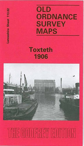
No Binding. Condition: New. No Jacket. Here are the details of maps for Toxteth & Liverpool (South): Lancs 113.02a Toxteth 1890 - published 2015; intro by Kay Parrott. ISBN.978-1-84784-907-6 Lancs 113.02b Toxteth 1906 - published 1989; intro by Naomi Evetts. ISBN.978-0-85054-234-9 We have published two versions of this map, showing how the area developed across the years. The 1890 version is in full colour, taken from the beautiful 1st Edition OS handcoloured map. The maps cover a busy area of south Liverpool, largely comprising the western half of Toxteth. Each is double-sided for maximum coverage. Coverage of the main map stretches from the docks eastward to Maud Street and Park Hill Road, and from Parliament Street southward to Beresford Road. The many features include Coburg Dock, Brunswick Dock, Toxteth Dock, part of Harrington Dock, Overhead Railway with several stations, Brunswick Goods station, South Docks Goods station, Brunswick Docks goods station, engine sheds and many sidings etc, tramways, countless streets of terraced houses, City Hospital, section of Cheshire Lines Railway, public baths, South End Mills, schools and chapels, Royal Southern Hospital, Mersey Brewery and bottling stores, etc. On the reverse we include adjacent sheet 113.06, extending coverage southward to include Herculaneum Dock, Park Hill Hospital, Petroleum Stores and Dingle Bank. This map links up with sheet 106.14 Central Liverpool to the north, 113.03 Liverpool Princes Pk to the east.
-

Toxteth 1906 (Folded)
Published by Alan Godfrey Maps, Co Durham, 1989
ISBN 10: 0850542340ISBN 13: 9780850542349
Book
Folded. Condition: new. Folded. Shipping may be from our UK warehouse or from our Australian or US warehouses, depending on stock availability.
-

Evetts, N: Toxteth 1906
Published by Alan Godfrey Maps, 1989
ISBN 10: 0850542340ISBN 13: 9780850542349
Book
Condition: New.