
Order Total (1 Item Items):
Shipping Destination:

Charles Bricker Tooley (83 results)
Skip to main search results
Product Type
- All Product Types
- Books (81)
- Magazines & Periodicals
- Comics
- Sheet Music
- Art, Prints & Posters
- Photographs
- Maps (2)
-
Manuscripts &
Paper Collectibles
Condition
Binding
- All Bindings
- Hardcover (77)
- Softcover
Collectible Attributes
- First Edition (11)
- Signed
- Dust Jacket (50)
- Seller-Supplied Images (22)
- Not Printed On Demand
Free Shipping
Seller Location
Seller Rating
-

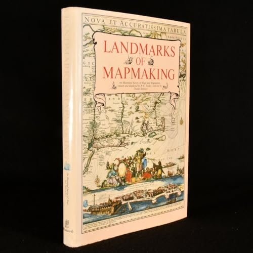
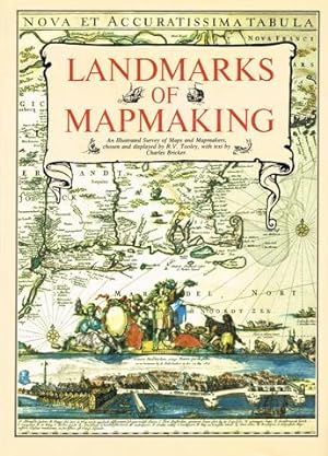
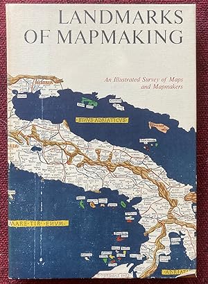
Landmarks of Mapmaking: An Illustrated History of Maps and Mapmakers
Published by Dorset, 1989
ISBN 10: 0880293497ISBN 13: 9780880293495
Book
Hardcover. Condition: Good.
More buying choices from other sellers on AbeBooks
New offers from US$ 17.99
Used offers from US$ 4.21
Also find Hardcover First Edition
-

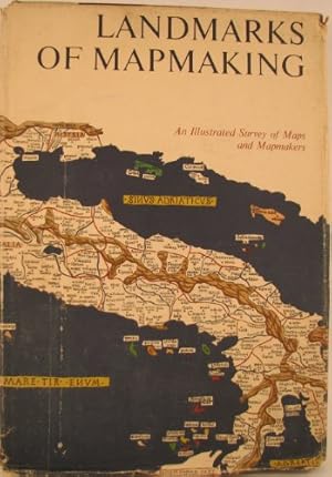
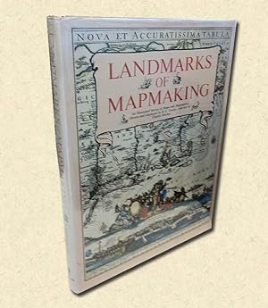
LANDMARKS OF MAPMAKING
Published by Crowell, NY, 1976
Seller: Neil Shillington: Bookdealer/Booksearch, Hobe sound, FL, U.S.A.
Seller Rating:

Hardback. Condition: Good. Dust Jacket Condition: Fair. Chipping to dust jacket.; 276 pages.
-

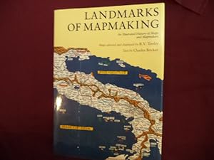
Landmarks of Mapmaking: Illustrated Survey of Maps & Mapmakers
Published by Thomas Y. Crowell, 1976
ISBN 10: 0690011776ISBN 13: 9780690011777
Book
Hardcover. Condition: Very Good. Thomas Y. Crowell January 1976 Binding: Hardcover INCLUDES DJ.
More buying choices from other sellers on AbeBooks
New offers from US$ 54.48
Used offers from US$ 14.48
Also find Hardcover First Edition
-
Landmarks of Mapmaking
Published by Elsevier, Amsterdam, The Netherlands, 1968
Seller: Xochi's Bookstore & Gallery, Truth or consequences, NM, U.S.A.
Seller Rating:

Book
Hardcover. Condition: Very Good+. No Jacket. 276pp.incl.index; HB lt.beige w/white&gilt; slight rub w/clean,tight pgs. "An Illustrated Survey of Maps and Mapmakers".
-
Landmarks of Mapmaking
Published by Wordsworth Editions Ltd, 1989
ISBN 10: 1853269360ISBN 13: 9781853269363
Book
Hardcover. Condition: Used; Good. Dispatched, from the UK, within 48 hours of ordering. This book is in good condition but will show signs of previous ownership. Please expect some creasing to the spine and/or minor damage to the cover.
More buying choices from other sellers on AbeBooks
Used offers from US$ 13.10
Also find First Edition
-
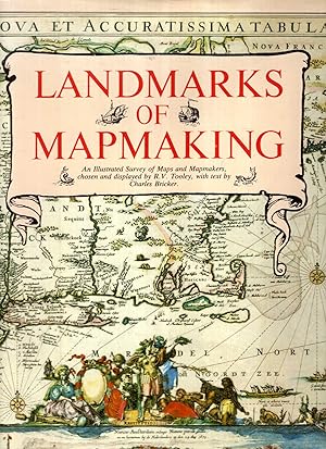
Landmarks of Mapmaking. An Illustrated Survey of Maps and Mapmakers. Maps Chosen and Displayed by R. V. Tooley. Text Written by Charles Bricker.
Published by New York: Thomas Y. Crowell, 1976., 1976
Seller: Scientia Books, ABAA ILAB, Arlington, MA, U.S.A.
Association Member: ABAA ILAB SNEAB
Seller Rating:
Book
Hardcover. Condition: Near Fine. Dust Jacket Included. 276 pp; many illustrations. Folio. Original cloth. Near Fine, in dust jacket. There are some small tears along the edges of the dust jacket, and a small stain on the front panel of the dust jacket, but the front flap of the dust jacket is not price-clipped! This copy does NOT have any library markings. First American Edition (originally published by Elsevier in Amsterdam in 1968). NOTE: there will be a substantial extra shipping charge if this book is sent outside the United States.
-
Geschichte der mittelalterlichen Kartographie Gewicht in Gramm: 550 Schutzumschlag etwas fleckig, sonst gut.
-
Condition: Good++, Good. 1968. elephant folio, 276 pgs, inserts, Hardcover Hardcover: Linen bound boards with design in gold on lower front board. Title on spine in gold with white/gold printed bands. Top spine edge is frayed through down to board. Corners are lightly bumped. Nice illustrated endpapers. Absolutely fascinating text with gorgeous Fold-out antique map reproductions. Nice tight binding. Color map illustrated dust jacket has edgewear and chipping to corners, spine ends and all edges. Lamination is gone from sections of the jacket. Foxed with some soil. Closed tears, rubbing. In protective mylar.
-
Condition: Good. Most items will be dispatched the same or the next working day. A tan to the page edges/pages. Minor wear. No Dust Jacket. Minor damage to the corner of the cover.
-
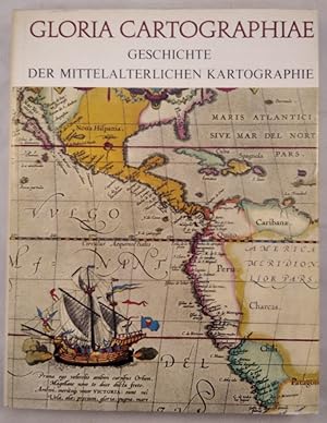
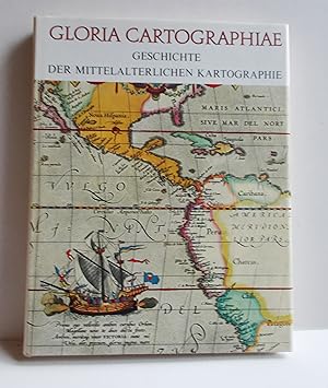
Gloria Cartographiae. Geschichte der mittelalterlichen Kartographie.
Published by Kartographisches Institut Bertelsmann, 1971
ISBN 10: 3570031292ISBN 13: 9783570031292
Book First Edition
Gebundene Ausgabe, Leinen, SU. Condition: Sehr gut. 1. Aufl.,. 240 Seiten, illustriert, Buch sehr gut erhalten, nur SU ganz leicht berieben und etwas lichtrandig. ISBN: 9783570031292 Sprache: Deutsch Gewicht in Gramm: 1130.
More buying choices from other sellers on AbeBooks
Used offers from US$ 15.47
Also find First Edition
-
Landmarks of Mapmaking; an Illustrated Survey of Maps and Mapmakers. Maps Chosen and Displayed by R.V. Tooley. Preface by Gerald Roe Crone
Published by Elsevier, Amsterdam, Netherlands, 1968
Hardcover. Condition: Very Good. Dust Jacket Condition: Good+. 1968. Nice Firm Clean copy ! Light general wear. 276 pages. 6503L.
-
Landmarks of Mapmaking; An Illustrated Survey of Maps and Mapmaking
Published by . Amsterdam, Brussels, Elsevier, [1976], First American edition., 1976
folio [41 x 28 cm]; 276 pp, over 350 illus, including maps, portraits, title pages and reproductions from early sources, 14 color double-page folding maps, other color illus, bibliog, index. original cloth, gilt lettering, gilt and white vignette on front cover, pictorial endpapers, dj (lightly rubbed at edge, price clipped), a fine copy in lightly worn very good dj, covers bright. A standard reference and a beautifully produced and illustrated work covering the development of cartography, the exploration and mapping of Europe, Asia, Africa, the Americas and Australia. Tooley and Crone were major authorities in the field of cartography. Print and antique stores have framed maps from other copies of this book because of their high quality. A picture of this book is available on request.
-
Landmarks of Mapmaking
Published by dorset press, Hertfordshire, 1981
Seller: Argosy Book Store, ABAA, ILAB, New York, NY, U.S.A.
Seller Rating:

hardcover. Condition: very good(+). 350 illus. and 14 fold-out maps, 10 in full color. folio, brown cloth boards, d.w.(price tag sticker on cover).N.Y., 1976. An illustrated survey of 2,000 years of maps and mapmakers. slightly smaller than original edition still a beautiful copy.
-
![Seller image for Gloria cartographiae. Geschichte der mittelalterlichen Kartographie. [�bersetzung aus dem Niederl�ndischen von G�nther Deschner]. for sale by Antiquariat Dietmar Brezina](https://pictures.abebooks.com/inventory/md/md31740330771.jpg)
Gloria cartographiae. Geschichte der mittelalterlichen Kartographie. [�bersetzung aus dem Niederl�ndischen von G�nther Deschner].
Published by G�tersloh u. Berlin, Kartographisches Institut Bertelsmann,, 1971
Book
Mit zahlr. (tls. farb.) Illustrationen auf Tafeln u. im Text. 240 S. Mit Register (3-spaltig). - Der Schuber etwas randgebr�unt, ansonsten sehr gutes Exemplar. Sprache: Deutsch Gewicht in Gramm: 1500 4�. Orig.-Leinenband mit farbig illustr. Orig.-Schutzumschlag. Orig.-Pappschuber.
-
Landmarks of Mapmaking: An Illustrated Survey of Maps and Mapmakers
Published by Westminster Editions, 1981
ISBN 10: 187212805XISBN 13: 9781872128054
Seller: Pendleburys - the bookshop in the hills, Llanwrda, United Kingdom
Seller Rating:
Book
hardback. Condition: Very Good. Dust Jacket Condition: Very Good. hardback, small folio measuring 14 1/4" x 10 1/2", a very good tightly bound copy in a well preserved pictorial dust wrapper that has faded a little to spine, the text is clean and is unmarked, folding colour maps, b&w maps, illustrations, 276pp. Owing to size and weight, a request for additional postage might be made if ordered from certain overseas locations.
More buying choices from other sellers on AbeBooks
Used offers from US$ 24.38
-

Geschiedenis van de cartografie.
Published by Alphen aan den Rijn, Atrium, 1981., 1981
ISBN 10: 9061134048ISBN 13: 9789061134046
Book
26 x 37, 275 pages, tr�s nombreuses cartes en couleurs, quelques illustrations et cartes en N/B (very many color maps, some pictures and maps in B/W), reliure d'�dition pleine toile + jaquette (hardcover + dustjacket), tr�s bon �tat (cachet d'ex-propri�taire) (very fine condition). Livre en n�erlandais.
-
Landmarks of Mapmaking. An Illustrated Survey of Maps and Mapmaking.
Seller: Hatt Rare Books ILAB & CINOA, H�gersten, Sweden
Seller Rating:
Publisher's brown cloth, pictorial dust-jacket in colour, very fine. Oxford, Phaidon Press Ltd, 1989. 4vo. 276 pp. Profusely illustrated with historical maps in colour, some folding. With index. Contents: "Introduction: the Mapmaker's Skills", "Europe: the Rise of Map Publishing", "Asia: Seaway to the Indies", "Africa: the Mysterious Continent", "The Americas: a New World", "Australia; the Southern Land".
-
Landmarks of Mapmaking
Published by Oxford Phaidon, 1976
ISBN 10: 0714817589ISBN 13: 9780714817583
Map First Edition
1st English Edition, Folio (40cms x 28cms), 9pp prelims, 260pp text with numerous b/w and coloured ilustrations, many full page and folded, 6pp index. Very good plus in brown boards with silver compass motif, cream spine compartmented with white and silver titles. Clipped pictorial D/W now protected. Very heavy at 2.8 kgs.
More buying choices from other sellers on AbeBooks
Used offers from US$ 25.83
Also find First Edition
-
Geschiedenis van de Cartografie.
Published by Alphen am Rhein, Atrium 1981., 1981
Folio. 275 S. m. zahlr. Abb. u. Tafeln. Oln. m. Schutzumschlag. Exlibris.
-
Gloria Cartographiae (Geschichte der mittelalterlichen Kartographie)
Published by G�tersloh. Kartographisches Institut Bertelsmann, 1969, 1969
Ganzleinen mit Schutzumschlag im Schuber, 4�(22 x 28 cm), 239 S., durchgehend mit sW und farbigen Abbildungen auf Tafeln, �Der Lesr wird auch mit den Karten des Altertums bekannt gemacht, auf denen die Welt noch in den wunderlichsten Formen dargestellt ist. Er lernt die runden, mit christlicher Symbolik verzierten Weltkarten des Mittelalters kennen, die erste r�mische Stra�enkarte, die erste Seekarte, die �ltesten Karten der Pilger und Kreuzfahrer und die fr�hesten, bekannten Stadtpl�ne.� Guter Zustand.
-
Landmarks of Mapmaking: An Illustrated Survey of Maps and Mapmaking
Published by Wordsworth Editions Ltd, Hertfordshire, 1989
ISBN 10: 1853269360ISBN 13: 9781853269363
Book First Edition
Hardcover. Condition: Very Good. Dust Jacket Condition: Very Good. 1st Edition Thus. First edition thus, hardcover featuring fold out maps, has a shallow lean to the binding, light bumps to the spine ends and cover corners, some mild edge wear with a hint of rubbing to the covers, and a very small, thin scrape to the fore edge of about half of the text block, otherwise a solid, tight Very Good copy in a like dust jacket, which has light bumps to the spine ends and corners, mild sunning to the spine, and a touch of shelfwear to the edges. Jacket is wrapped in a Mylar cover.
-
Landmarks of Mapmaking. An Illustrated Survey of Maps and Mapmakers.
Published by Dorset Press., New York., 1989
Gilt decorated hard cover. First edition thus. Illustrated in black, white and color. Important reference work. Very scarce in this condition. Fine copy in fine (very light rubbing to front panel) dust jacket. 276 pps.
-
Landmarks of Mapmaking. An Illustrated Survey of Maps and Mapmakers. Text by Ch. Bricker.
Published by Amsterdam, Brussels, Elsevier, 1968, 1968
Amsterdam, Brussels, Elsevier, 1968 Folio. Hardbound with pictorial dustjacket. 276 pp. Dustjacket frayed, otherwise in good condition.
-
Wordsworth 1981. 276 pages. Folio. Original cloth. Dust jacket. Very fine.*An illustrated survey of Maps and Mapmakers.[#208798].
-
Gloria Cartographiae. Geschichte der mittelalterlichen Kartographie.
Published by G�tersloh, Kartographisches Institut Bertelsmann,, 1971
Book
240 S. mit zahlreichen Abbildungen im Text und Karten auf Tafeln. Sprache: Deutsch Gewicht in Gramm: 1180 4�, Originalganzleinenband mit Schutzumschlag.
-
LANDMARKS OF MAPMAKING. AN ILLUSTRATED SURVEY OF MAPS AND MAPMAKERS.
Publication Date: 1976
Seller: Graham York Rare Books ABA ILAB, Honiton, United Kingdom
Association Member: ABA ILAB PBFA
Seller Rating:
Map
Condition: Very good. 1976, Oxford, Phaidon, folio, reprint, pp276, colour and black and white maps and illustrations, cream cloth spine over brown rexine in dustwrapper in open cardboard sleeve. This is a large, heavy book and will incur extra postage.
-
LANDMARKS OF MAPMAKING An Illustrated Survey of Maps and Mapmakers
Published by Elsevier, Amsterdam, 1968
Hardcover. Condition: Very Good+. Dust Jacket Condition: Very Good. Folio 13" - 23" tall; 276 pages; Minor rubbing and edgewear to the dust jacket with some chips and peeling to the lamination along the top edge.
-
Landmarks of Mapmaking: An Illustrated Survey of Maps and Mapmakers
Published by Elsevier, Amsterdam/ Brucelles, 1968
First Edition
Hardcover. Condition: Good. Dust Jacket Condition: Fair (mylar). 1st Edition. 276 pp. Gilt titles: sp.Gilt embossed design, frt. bd. Illust. w/ b/w and colour facsimile maps, prints, engravings, and folded full pg. maps. Grey cloth bds. Decorated e.p.s. Crown of Dj damp-stained w/ some closed tears end to end. Bds. not efected. Interior leaves are clean and tight. An elegant volume displaying the mapmakers art with accompanying text. Includes short bibliography and index. Extra postage due.
-
Landmarks of Mapmaking: An Illustrated Survey of Maps and Mapmakers
Published by Wordsworth editions, Ware,, 1989
Large quarto hardcover; brown buckram boards with gilt spine titling and yellow endpapers; 276pp., colour & b&w maps and illustrations, many fold-out maps. Minor wear; mild wear to board edges and corners; lightly toned and spotted text block and page edges. Illustrated dustwrapper slightly faded along the spine panel and mild wear to edges; now professionally protected by superior non-adhesive polypropylene film. Near fine. Postage quoted is for a standard format octavo book. Final charges may vary depending on size and weight.
-
Landmarks of Mapping; an Illustrated Survey of Maps and Makers
Published by Elsevier, Amsterdam & Brussels, 1968
Cloth Over Board. Condition: Good. No Jacket. Tooley, R. V. {compiled maps} (illustrator). This very large book is bound in a light 'oatmeal' cloth with gilt lettering and design framed in white on spine and front cover, back cover is plain. Bottom corners are lightly bumped, fraying cloth at tail of spine. Some discoloration bottom edge of front board, tail of spine, very light on back board and text sheets due to a spill. Very slight forward cocking of the binding. Hinges and gutters are solid, very light early foxing of endpapers and edges. 'Dirt' mark near center fore-edge of the half-title page. Numerous illustrations: Black and white, full color plates and duo-folds. An interesting look at the development of mapping and knowledge. Due to the large size and weight of this book, it will require additional shipping. Size: Elephant Folio - over 15" - 23" tall.
