The South Downs Way Map Booklet: 1:25,000 OS Route Mapping - Softcover

South Downs Way Map Booklet
"synopsis" may belong to another edition of this title.
About the Author:
Kev Reynolds is a freelance writer, photojournalist and lecturer. A prolific compiler of guidebooks, his first title for Cicerone Press (Walks & Climbs in the Pyrenees) appeared in 1978; he has since produced many more titles for the same publisher, with others in the pipeline. His passion for mountains and the countryside remains undiminished after a lifetime's activity, and he regularly travels throughout Britain to share that enthusiasm through his lectures.
"About this title" may belong to another edition of this title.
- PublisherCicerone Press
- Publication date2017
- ISBN 10 1852849398
- ISBN 13 9781852849399
- BindingPaperback
- Number of pages64
- Rating
Buy New
Learn more about this copy
US$ 23.30
Shipping:
FREE
Within U.S.A.
Top Search Results from the AbeBooks Marketplace
Seller Image
South Downs Way Map Booklet (Paperback)
Published by
Cicerone Press, Kendal
(2021)
ISBN 10: 1852849398
ISBN 13: 9781852849399
New
Paperback
Quantity: 1
Seller:
Rating
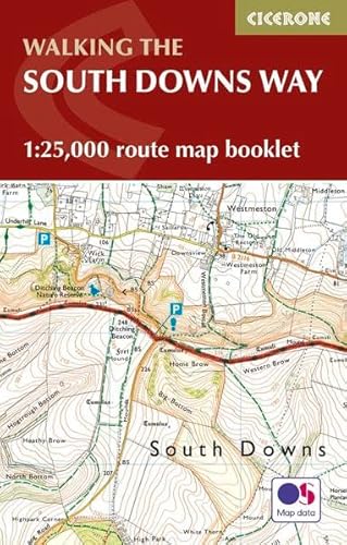
Book Description Paperback. Condition: new. Paperback. All the mapping you need to complete the 100 mile (160km) South Downs Way National Trail, between Eastbourne and Winchester. With easy walking on ancient trackways, the route features wooded areas, river valleys and attractive villages and is rich in natural, geological and historical interest. This booklet of Ordnance Survey 1:25,000 Explorer maps has been designed for convenient use on the trail. It shows the full and up-to-date line of the route along with the relevant extract from the OS Explorer map legend, and can be used when walking the trail in either direction. Conveniently sized for slipping into a jacket pocket or the top of a rucksack, it comes in a clear PVC sleeve. An accompanying Cicerone guidebook - The South Downs Way - describes the full route in both directions and includes lots of other practical and historical information, for those who prefer a written guide. The guidebook INCLUDES a copy of this map booklet. Map of the 100 mile (160km) South Downs Way National Trail, between Eastbourne and Winchester. This booklet is included with the Cicerone guidebook to the trail and shows the full route on OS 1:25,000 maps. The trail typically takes a week to walk and is suitable for most levels of ability. Shipping may be from multiple locations in the US or from the UK, depending on stock availability. Seller Inventory # 9781852849399
Buy New
US$ 23.30
Convert currency
Seller Image
South Downs Way Map Booklet (Paperback)
Published by
Cicerone Press, Kendal
(2021)
ISBN 10: 1852849398
ISBN 13: 9781852849399
New
Paperback
Quantity: 1
Seller:
Rating
Book Description Paperback. Condition: new. Paperback. All the mapping you need to complete the 100 mile (160km) South Downs Way National Trail, between Eastbourne and Winchester. With easy walking on ancient trackways, the route features wooded areas, river valleys and attractive villages and is rich in natural, geological and historical interest. This booklet of Ordnance Survey 1:25,000 Explorer maps has been designed for convenient use on the trail. It shows the full and up-to-date line of the route along with the relevant extract from the OS Explorer map legend, and can be used when walking the trail in either direction. Conveniently sized for slipping into a jacket pocket or the top of a rucksack, it comes in a clear PVC sleeve. An accompanying Cicerone guidebook - The South Downs Way - describes the full route in both directions and includes lots of other practical and historical information, for those who prefer a written guide. The guidebook INCLUDES a copy of this map booklet. Map of the 100 mile (160km) South Downs Way National Trail, between Eastbourne and Winchester. This booklet is included with the Cicerone guidebook to the trail and shows the full route on OS 1:25,000 maps. The trail typically takes a week to walk and is suitable for most levels of ability. Shipping may be from our Sydney, NSW warehouse or from our UK or US warehouse, depending on stock availability. Seller Inventory # 9781852849399
Buy New
US$ 21.25
Convert currency
Seller Image
South Downs Way Map Booklet (Paperback)
Published by
Cicerone Press, Kendal
(2021)
ISBN 10: 1852849398
ISBN 13: 9781852849399
New
Paperback
Quantity: 1
Seller:
Rating
Book Description Paperback. Condition: new. Paperback. All the mapping you need to complete the 100 mile (160km) South Downs Way National Trail, between Eastbourne and Winchester. With easy walking on ancient trackways, the route features wooded areas, river valleys and attractive villages and is rich in natural, geological and historical interest. This booklet of Ordnance Survey 1:25,000 Explorer maps has been designed for convenient use on the trail. It shows the full and up-to-date line of the route along with the relevant extract from the OS Explorer map legend, and can be used when walking the trail in either direction. Conveniently sized for slipping into a jacket pocket or the top of a rucksack, it comes in a clear PVC sleeve. An accompanying Cicerone guidebook - The South Downs Way - describes the full route in both directions and includes lots of other practical and historical information, for those who prefer a written guide. The guidebook INCLUDES a copy of this map booklet. Map of the 100 mile (160km) South Downs Way National Trail, between Eastbourne and Winchester. This booklet is included with the Cicerone guidebook to the trail and shows the full route on OS 1:25,000 maps. The trail typically takes a week to walk and is suitable for most levels of ability. Shipping may be from our UK warehouse or from our Australian or US warehouses, depending on stock availability. Seller Inventory # 9781852849399
Buy New
US$ 21.52
Convert currency