Coloured Edition (Old Ordnance Survey Maps of Warwickshire)
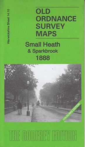

We have published two versions of this map, showing how the area changed across the years. The 1888 version is fully coloured, taken from the beautiful 1st edition OS handcoloured map. The maps cover the Small Heath area of Birmingham, and also includes the eastern part of Sparkbrook, and smaller parts of Bordesley and Balsall Heath. Coverage stretches from Gladstone Road eastward to Hay Barn Farm and Hay Mills, and from Kenelm Road southward to Alfred Road. Features include Victoria Park, Coventry Road area, Golden Hillock Road, Birmingham Small Arms Factory, St Cyprian's church, Hay Hall, Warwick & Birmingham Canal, Emmanuel church, GWR railway with Small Heath station, engine shed, Westminster Works, tramways, Football Ground, Matchless cycle works, Christ Church, River Cole etc. On the reverse we include extracts from an early directory.
"synopsis" may belong to another edition of this title.
- PublisherAlan Godfrey Maps
- Publication date2016
- ISBN 10 1847849660
- ISBN 13 9781847849663
- BindingMap
Buy New
Learn more about this copy
US$ 3.59
Shipping:
US$ 38.64
From United Kingdom to U.S.A.
Top Search Results from the AbeBooks Marketplace
Stock Image
Small Heath & Sparkbrook 1888: Warwickshire Sheet 14.10a: Coloured Edition
Seller:
Rating
Book Description No Binding. Condition: New. No Jacket. Here are the details of maps for Small Heath: Warwickshire Sheet 14.10a Small Heath & Sparkbrook 1888 - published 2016; intro by Barrie Trinder. ISBN.978-1-84784-966-3 Warwickshire Sheet 14.10b Small Heath & Sparkbrook 1903 - published 2000; intro by Richard Abbott. ISBN.978-1-84151-154-2 We have published two versions of this map, showing how the area changed across the years. The 1888 version is fully coloured, taken from the beautiful 1st edition OS handcoloured map. The maps cover the Small Heath area of Birmingham, and also includes the eastern part of Sparkbrook, and smaller parts of Bordesley and Balsall Heath. Coverage stretches from Gladstone Road eastward to Hay Barn Farm and Hay Mills, and from Kenelm Road southward to Alfred Road. Features include Victoria Park, Coventry Road area, Golden Hillock Road, Birmingham Small Arms Factory, St Cyprian's church, Hay Hall, Warwick & Birmingham Canal, Emmanuel church, GWR railway with Small Heath station, engine shed, Westminster Works, tramways, Football Ground, Matchless cycle works, Christ Church, River Cole etc. On the reverse we include extracts from an early directory. The map links up with sheets 14.06 Birmingham East to the north, 14.09 Birmingham South to the west, 14.11 South Yardley to the east and 14.14 Sparkhill to the south. Seller Inventory # 002554
Buy New
US$ 3.59
Convert currency