Bristol (Fishponds) 1902: Gloucestershire Sheet 72.10 (Old Ordnance Survey Maps of Gloucestershire)

Buy New
Learn more about this copy
US$ 3.60
Shipping:
US$ 38.79
From United Kingdom to U.S.A.
Top Search Results from the AbeBooks Marketplace
Stock Image
Bristol (Fishponds) 1902: Gloucestershire Sheet 72.10 (Old Ordnance Survey Maps of Gloucestershire)
Seller:
Rating
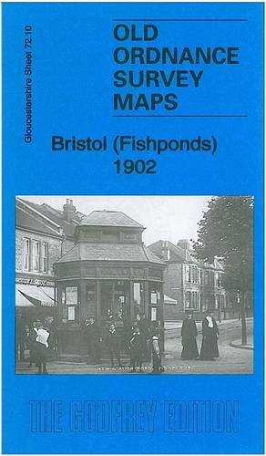
Book Description No Binding. Condition: New. No Jacket. Here are the details of maps for Bristol Fishponds: Gloucestershire Sheet 72.10 Bristol (Fishponds) 1902 - published 2012; intro by Mike Bone. ISBN.978-1-84784-629-7 This detailed map covers the Fishponds, Ridgeway, Upper Eastville and Mayfield Park areas of Bristol. Features include tramways, Midland Railway with Stapleton (later Fishponds) station, Kingswood Junction, Hollybrook Brick Works, Chester Park area, Atlas Locomotive Works, Weighing Machine Works, Clay Hill, brick works, Greenbank Cemetery, St Mary's church, St John's Mission Church, Ridgeway Park Cemetery, Ridgeway House, part of Eastville Park, Clay Bottom etc. An 1894 directory of Fishponds is included on the reverse. The map links up with sheets 72.06 Frenchay to the north, 72.09 Ashley Down to the west, 72.11 Staple Hill to the east, 72.14 St Georges to the south. Seller Inventory # 005743
Buy New
US$ 3.60
Convert currency