Willesden 1912: London Sheet 35.3 (Old Ordnance Survey Maps of London)

Buy New
Learn more about this copy
US$ 3.81
Shipping:
US$ 38.18
From United Kingdom to U.S.A.
Top Search Results from the AbeBooks Marketplace
Stock Image
Willesden 1912: London Sheet 35.3 (Old Ordnance Survey Maps of London)
Seller:
Rating
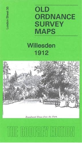
Book Description No Binding. Condition: New. No Jacket. Here are the details of maps for Willesden: London Sheet 35.2 Willesden & Stonebridge Park 1894 - published 1985; intro by Judith Knight. ISBN.978-0-907554-91-2 London Sheet 35.3 Willesden 1912 - published 2022; intro by Alan Godfrey. ISBN.978-1-78721-570-2 London Sheet 35.4 Willesden & Stonebridge Park 1936 - published 2014; intro by Pamela Taylor. ISBN.978-1-84784-810-9 We have published three versions of this map, showing how the area changed across the years. It includes the Church End area of Willesden, much of Harlesden to the south, and the newly built Stonebridge Park. Features (from the 1912 version) include St Mary's church, Church End, tramway, Chapel End, part of Willesden Green, St Andrew's church, Passmore Edwards Hospital, Roundwood Park, Roundwood House, convent, cemetery, Jews Cemetery, St Cecilia's church, Acton Branch railway, etc The map links up with London Sheets 25 Neasden to the north, 36 Willesden Green to the east, 46 Willesden Junction to the south; and with Middlesex sheet 16.01 Alperton to the west. Seller Inventory # 010846
Buy New
US$ 3.81
Convert currency