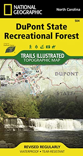
DuPont State Recreational Forest Map (National Geographic Trails Illustrated Map, 504)

� Waterproof � Tear-Resistant � Topographic Map
In the late 1990's the Friends of DuPont Forest, a volunteer service organization, started acquiring land for the first State Recreation Forest in the country. After years of work acquiring land the DuPont State Recreation Forest now includes over 80 miles of trails that cover an intricate trail network. Most of these trails are open to hiking, equestrian, and mountain bike use. A few have been designated as hiking only to give hikers an opportunity to use trails at a slower pace. Each trail has a difficulty rating and mileage marked on the map, no need to look up this information in a separate table. One of the main draws of the State Recreation Forest is the abundance of waterfalls. There is even a waterfall table to help locate these amazing features and help with planning.
The back side of the printed map includes a group of selected loop trails for all abilities from beginner to expert. Each suggested loop has a trail profile that clearly shows the climbs and decents as well as trail crossings and other waypoints along the way. The loops also include turn by turn directions and commentary on interesting landmarks along the way.
Every Trails Illustrated map is printed on "Backcountry Tough" waterproof, tear-resistant paper. A full UTM grid is printed on the map to aid with GPS navigation.
Other features found on this map include: DuPont State Recreation Forest.
- Map Scale = 1:22,500
- Sheet Size = 26.25" x 19.5"
- Folded Size = 4" x 7.5"
"synopsis" may belong to another edition of this title.
About the Author:
Founded in 1915 as the Cartographic Group, the first division of National Geographic, National Geographic Maps has been responsible for illustrating the world around us through the art and science of mapmaking.Today, National Geographic Maps continues this mission by creating the world's best wall maps, recreation maps, atlases, and globes which inspire people to care about and explore their world.
"About this title" may belong to another edition of this title.
- PublisherNatl Geographic Society Maps
- Publication date2021
- ISBN 10 1597756253
- ISBN 13 9781597756259
- BindingMap
- Number of pages2
Buy New
Learn more about this copy
US$ 14.97
Shipping:
FREE
Within U.S.A.
Top Search Results from the AbeBooks Marketplace
Stock Image
DuPont State Recreational Forest Map (National Geographic Trails Illustrated Map, 504)
Published by
Natl Geographic Society Maps
(2021)
ISBN 10: 1597756253
ISBN 13: 9781597756259
New
Quantity: 1
Seller:
Rating
Book Description Condition: New. Buy with confidence! Book is in new, never-used condition. Seller Inventory # bk1597756253xvz189zvxnew
Buy New
US$ 14.97
Convert currency
Stock Image
DuPont State Recreational Forest Map (National Geographic Trails Illustrated Map, 504)
Published by
Natl Geographic Society Maps
(2021)
ISBN 10: 1597756253
ISBN 13: 9781597756259
New
Quantity: 1
Seller:
Rating
Book Description Condition: New. New! This book is in the same immaculate condition as when it was published. Seller Inventory # 353-1597756253-new
Buy New
US$ 14.97
Convert currency
Stock Image
DuPont State Recreational Forest Map (National Geographic Trails Illustrated Map, 504)
Published by
Natl Geographic Society Maps
(2021)
ISBN 10: 1597756253
ISBN 13: 9781597756259
New
Quantity: 5
Seller:
Rating
Book Description Condition: New. Seller Inventory # I-9781597756259
Buy New
US$ 15.00
Convert currency
Stock Image
DuPont State Recreational Forest (National Geographic Trails Illustrated Map, 504)
Published by
Natl Geographic Society Maps
(2019)
ISBN 10: 1597756253
ISBN 13: 9781597756259
New
Quantity: 1
Seller:
Rating
Book Description Map. Condition: New. Seller Inventory # DADAX1597756253
Buy New
US$ 15.54
Convert currency
Stock Image
Dupont State Recreational Forest
Published by
National Geographic Maps Division 2015-12-04, Washington, D.C.
(2015)
ISBN 10: 1597756253
ISBN 13: 9781597756259
New
Quantity: 5
Seller:
Rating
Book Description sheet map (folded). Condition: New. Language: ENG. Seller Inventory # 9781597756259
Buy New
US$ 15.43
Convert currency
Stock Image
Dupont State Recreational Forest National Geographic Trails Illustrated Map
Published by
National Geographic Maps Division
(2015)
ISBN 10: 1597756253
ISBN 13: 9781597756259
New
Quantity: 6
Seller:
Rating
Book Description UNK. Condition: New. New Book. Shipped from UK. Established seller since 2000. Seller Inventory # EA-9781597756259
Buy New
US$ 21.14
Convert currency
Stock Image
National Geographic Dupont State Recreational Forest Map
Seller:
Rating
Book Description Map. Condition: Brand New. 2015 edition. 1 pages. 7.30x3.80x0.20 inches. In Stock. Seller Inventory # x-1597756253
Buy New
US$ 12.58
Convert currency
Stock Image
Dupont State Recreational Forest National Geographic Trails Illustrated Map
Published by
National Geographic Maps Division
(2015)
ISBN 10: 1597756253
ISBN 13: 9781597756259
New
Quantity: 6
Seller:
Rating
Book Description UNK. Condition: New. New Book. Shipped from UK. Established seller since 2000. Seller Inventory # EA-9781597756259
Buy New
US$ 14.75
Convert currency
Seller Image
National Geographic Dupont State Recreational Forest Map
Published by
Natl Geographic Society Maps
(2021)
ISBN 10: 1597756253
ISBN 13: 9781597756259
New
Quantity: 1
Seller:
Rating
Book Description Condition: new. Book is in NEW condition. Satisfaction Guaranteed! Fast Customer Service!!. Seller Inventory # PSN1597756253
Buy New
US$ 17.88
Convert currency
Stock Image
Dupont State Recreational Forest (Folded)
Published by
National Geographic Maps, Evergreen
(2015)
ISBN 10: 1597756253
ISBN 13: 9781597756259
New
Quantity: 1
Seller:
Rating
Book Description Folded. Condition: new. Folded. Waterproof, Tear-Resistant Topographic Map. In the late 1990's the Friends of DuPont Forest, a volunteer service organization, started acquiring land for the first State Recreation Forest in the country. After years of work acquiring land the DuPont State Recreation Forest now includes over 80 miles of trails that cover an intricate trail network. Most of these trails are open to hiking, equestrian, and mountain bike use. A few have been designated as hiking only to give hikers an opportunity to use trails at a slower pace. Each trail has a difficulty rating and mileage marked on the map, no need to look up this information in a separate table. One of the main draws of the State Recreation Forest is the abundance of waterfalls. There is even a waterfall table to help locate these amazing features and help with planning. The back side of the printed map includes a group of selected loop trails for all abilities from beginner to expert. Each suggested loop has a trail profile that clear Shipping may be from our Sydney, NSW warehouse or from our UK or US warehouse, depending on stock availability. Seller Inventory # 9781597756259
Buy New
US$ 26.50
Convert currency