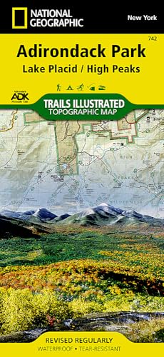
Lake Placid, High Peaks: Adirondack Park Map (National Geographic Trails Illustrated Map, 742)

� Waterproof � Tear-Resistant � Topographic Map
The largest park in the contiguous United States, Adirondack Park is a diverse mountain landscape of protected boreal forests and pristine waterways interspersed with over one hundred towns and villages. National Geographic's Trails Illustrated map of Adirondack Park combines unmatched detail with helpful information to offer an invaluable tool for making the most of your visit to this extraordinary region. Created in partnership with local land management agencies, this expertly researched map features key areas of interest including High Peaks Wilderness, Lake Placid, Sentinel Range Wilderness, Saranac Lakes Wild Forest, Lake Champlain, Giant Mountain Wilderness, Hurricane Mountain Wilderness, Split Rock Mountain Wild Forest, and Long Lake.
An extensive High Peaks Trail Chart will help you choose a trail that's right for your activity level and recreation use whether you're hiking, horseback riding, biking, snowshoeing, cross country skiing, or snowmobiling. Trails are clearly marked and include mileages between intersections. The map base includes contour lines and elevations for summits, passes and major lakes. Some of the many recreation features include: campgrounds, trailheads, fishing access, boat launch sites, and interpretive trails.
Every Trails Illustrated map is printed on "Backcountry Tough" waterproof, tear-resistant paper. A full UTM grid is printed on the map to aid with GPS navigation.
Other features found on this map include: Adirondack Mountains, Algonquin Peak, Ampersand Mountain, Ausable River, Basin Mountain, Boundary Peak, Dix Mountain, Gothics, Gray Peak, Iroquois Peak, Little Marcy, MacIntyre Mountains, Mount Haystack, Mount Marcy, Mount Skylight, Otter Creek, Owls Head Mountain, Sentinel Range, Split Rock Mountain, Street Mountain, Tupper Lake, Upper Saranac Lake, Vanderwhacker Mountain.
- Map Scale = 1:75,000
- Sheet Size = 37.75" x 25.5"
- Folded Size = 4.25" x 9.25"
"synopsis" may belong to another edition of this title.
About the Author:
Founded in 1915 as the Cartographic Group, the first division of National Geographic, National Geographic Maps has been responsible for illustrating the world around us through the art and science of mapmaking.Today, National Geographic Maps continues this mission by creating the world's best wall maps, recreation maps, atlases, and globes which inspire people to care about and explore their world.
"About this title" may belong to another edition of this title.
- PublisherNatl Geographic Society Maps
- Publication date2023
- ISBN 10 156695357X
- ISBN 13 9781566953573
- BindingMap
- Number of pages2
- Rating
Buy New
Learn more about this copy
US$ 10.79
Shipping:
US$ 3.99
Within U.S.A.
Top Search Results from the AbeBooks Marketplace
Stock Image
Lake Placid, High Peaks: Adirondack Park (National Geographic Trails Illustrated Map (742))
Published by
National Geographic Maps
(2023)
ISBN 10: 156695357X
ISBN 13: 9781566953573
New
Quantity: 1
Seller:
Rating
Book Description Condition: New. Brand New! Not Overstocks or Low Quality Book Club Editions! Direct From the Publisher! We're not a giant, faceless warehouse organization! We're a small town bookstore that loves books and loves it's customers! Buy from Lakeside Books!. Seller Inventory # OTF-S-9781566953573
Buy New
US$ 10.79
Convert currency
Stock Image
Lake Placid, High Peaks: Adirondack Park Map (National Geographic Trails Illustrated Map, 742)
Published by
Natl Geographic Society Maps
(2021)
ISBN 10: 156695357X
ISBN 13: 9781566953573
New
Quantity: > 20
Seller:
Rating
Book Description Map. Condition: New. Brand New!. Seller Inventory # 156695357X
Buy New
US$ 14.98
Convert currency
Stock Image
Lake Placid, High Peaks: Adirondack Park Map (National Geographic Trails Illustrated Map, 742)
Published by
Natl Geographic Society Maps
(2023)
ISBN 10: 156695357X
ISBN 13: 9781566953573
New
Quantity: 1
Seller:
Rating
Book Description Condition: New. Book is in NEW condition. Seller Inventory # 156695357X-2-1
Buy New
US$ 15.85
Convert currency
Stock Image
Lake Placid, High Peaks: Adirondack Park Map (National Geographic Trails Illustrated Map, 742)
Published by
Natl Geographic Society Maps
(2023)
ISBN 10: 156695357X
ISBN 13: 9781566953573
New
Quantity: 1
Seller:
Rating
Book Description Condition: New. New! This book is in the same immaculate condition as when it was published. Seller Inventory # 353-156695357X-new
Buy New
US$ 15.86
Convert currency
Stock Image
Lake Placid, High Peaks: Adirondack Park (National Geographic Trails Illustrated Map)
Published by
Natl Geographic Society Maps
(2012)
ISBN 10: 156695357X
ISBN 13: 9781566953573
New
Quantity: 1
Seller:
Rating
Book Description Map. Condition: New. Seller Inventory # DADAX156695357X
Buy New
US$ 15.89
Convert currency
Stock Image
Lake PlacidHigh Peaks, Adirondack Park Trails Illustrated Other Rec Areas National Geographic Trails Illustrated Map
Published by
National Geographic Maps
(2023)
ISBN 10: 156695357X
ISBN 13: 9781566953573
New
Quantity: 1
Seller:
Rating
Book Description UNK. Condition: New. New Book. Shipped from UK. Established seller since 2000. Seller Inventory # IB-9781566953573
Buy New
US$ 21.52
Convert currency
Stock Image
Lake Placid/high Peaks, Adirondack Park
Published by
National Geographic Maps Division 2012-08-02, Washington, D.C.
(2012)
ISBN 10: 156695357X
ISBN 13: 9781566953573
New
Quantity: 1
Seller:
Rating
Book Description sheet map (folded). Condition: New. Language: ENG. Seller Inventory # 9781566953573
Buy New
US$ 18.00
Convert currency
Stock Image
Lake Placid, High Peaks: Adirondack Park (National Geographic Trails Illustrated Map (742))
Published by
National Geographic Maps
(2019)
ISBN 10: 156695357X
ISBN 13: 9781566953573
New
Quantity: 1
Seller:
Rating
Book Description Map. Condition: New. 2019th Edition. Special order direct from the distributor. Seller Inventory # ING9781566953573
Buy New
US$ 14.95
Convert currency
Stock Image
National Geographic Trails Illustrated Topographic Map Adirondack Park: Lake Placid/ High Peaks: New York
Published by
Natl Geographic Society Maps
(2004)
ISBN 10: 156695357X
ISBN 13: 9781566953573
New
Quantity: 1
Seller:
Rating
Book Description Map. Condition: Brand New. map edition. 2 pages. 0.25x9.25x4.25 inches. In Stock. Seller Inventory # __156695357X
Buy New
US$ 15.54
Convert currency
Stock Image
National Geographic Trails Illustrated Topographic Map Adirondack Park: Lake Placid/ High Peaks: New York
Published by
Natl Geographic Society Maps
(2004)
ISBN 10: 156695357X
ISBN 13: 9781566953573
New
Quantity: 2
Seller:
Rating
Book Description Map. Condition: Brand New. map edition. 2 pages. 0.25x9.25x4.25 inches. In Stock. Seller Inventory # x-156695357X
Buy New
US$ 16.55
Convert currency