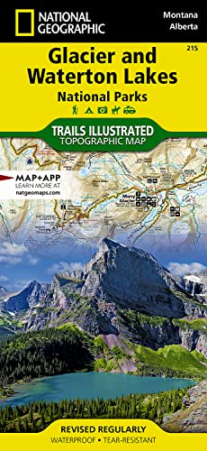
Glacier and Waterton Lakes National Parks Map (National Geographic Trails Illustrated Map, 215)

� Waterproof � Tear-Resistant � Topographic Map
National Geographic's Trails Illustrated map of Glacier and Waterton Lakes National Parks offers unparalleled detail for outdoor enthusiasts exploring the pristine landscape of forests, mountains, lakes, and meadows within these two spectacular parks. Created in partnership with local land management agencies, this expertly researched map features key areas of interest including Many Glacier, Great Bear Wilderness, Flathead National Forest, Hungry Horse Reservoir, Lake McDonald, Flathead River, St. Mary Lake, Akamina-Kishinena Provincial Park, and the Waterton Lakes.
The Glacier and Waterton Lakes map is an invaluable resource for exploring the more than 800 miles of mapped trails within the parks, including the Pacific Northwest Trail, the Continental Divide Trail, and recommended biking trails. Recreation features are clearly marked, including campgrounds, trailheads, interpretive trails, fishing and boat access, and horse rental locations. The map base includes contour lines and elevations for summits, passes and major lakes. A variety of helpful information about recreation activities available in the parks, hiking and backcountry camping, regulations, and safety tips are included as well.
Every Trails Illustrated map is printed on "Backcountry Tough" waterproof, tear-resistant paper. A full UTM grid is printed on the map to aid with GPS navigation.
Other features found on this map include: Apgar Mountains, Bowman Lake, Flathead National Forest, Flathead Range, Glacier, Great Bear Wilderness, Kintla Lake, Lake McDonald, Lake Sherburne, Lewis & Clark National Forest, Lewis Range, Livingston Range, Lower Saint Mary Lake, Mount Carter, Mount Cleveland, Mount Saint Nicholas, Mount Stimson, Saint Mary Lake, Upper Waterton Lake, Whitefish Lake.
- Map Scale = 1:100,000
- Sheet Size = 37.75" x 25.5"
- Folded Size = 4.25" x 9.25"
"synopsis" may belong to another edition of this title.
About the Author:
Founded in 1915 as the Cartographic Group, the first division of National Geographic, National Geographic Maps has been responsible for illustrating the world around us through the art and science of mapmaking.Today, National Geographic Maps continues this mission by creating the world's best wall maps, recreation maps, atlases, and globes which inspire people to care about and explore their world.
"About this title" may belong to another edition of this title.
- PublisherNational Geographic Maps
- Publication date2022
- ISBN 10 1566953189
- ISBN 13 9781566953184
- BindingMap
- Number of pages2
- Rating
Buy New
Learn more about this copy
US$ 12.89
Shipping:
FREE
Within U.S.A.
Top Search Results from the AbeBooks Marketplace
Seller Image
Glacier/Waterton Lakes National Parks, Montana, USA/Alberta, Canada: Outdoor Recreational Map (Sheet Map, Folded)
Published by
Rand McNally & Company 4/1/2009
(2009)
ISBN 10: 1566953189
ISBN 13: 9781566953184
New
Quantity: 5
Seller:
Rating
Book Description Sheet Map, Folded. Condition: New. Glacier/Waterton Lakes National Parks, Montana, USA/Alberta, Canada: Outdoor Recreational Map 0.2. Book. Seller Inventory # BBS-9781566953184
Buy New
US$ 12.89
Convert currency
Stock Image
Glacier and Waterton Lakes National Parks (National Geographic Trails Illustrated Map)
Published by
National Geographic Maps
(2022)
ISBN 10: 1566953189
ISBN 13: 9781566953184
New
Quantity: 19
Seller:
Rating
Book Description Condition: New. Brand New! Not Overstocks or Low Quality Book Club Editions! Direct From the Publisher! We're not a giant, faceless warehouse organization! We're a small town bookstore that loves books and loves it's customers! Buy from Lakeside Books!. Seller Inventory # OTF-S-9781566953184
Buy New
US$ 9.54
Convert currency
Stock Image
Glacier and Waterton Lakes National Parks Map (National Geographic Trails Illustrated Map, 215)
Published by
National Geographic Maps
(2022)
ISBN 10: 1566953189
ISBN 13: 9781566953184
New
Quantity: 1
Seller:
Rating
Book Description Condition: New. Buy with confidence! Book is in new, never-used condition. Seller Inventory # bk1566953189xvz189zvxnew
Buy New
US$ 14.81
Convert currency
Stock Image
Glacier and Waterton Lakes National Parks Map (National Geographic Trails Illustrated Map, 215)
Published by
National Geographic Maps
(2022)
ISBN 10: 1566953189
ISBN 13: 9781566953184
New
Quantity: 1
Seller:
Rating
Book Description Condition: New. New! This book is in the same immaculate condition as when it was published. Seller Inventory # 353-1566953189-new
Buy New
US$ 14.81
Convert currency
Stock Image
Glacier & Waterton Lakes National Park, MT - Trails Illustrated Map #215 (National Geographic Maps: Trails Illustrated)
Published by
Natl Geographic Society Maps
(2008)
ISBN 10: 1566953189
ISBN 13: 9781566953184
New
Quantity: 1
Seller:
Rating
Book Description Map. Condition: New. 2. Seller Inventory # DADAX1566953189
Buy New
US$ 14.82
Convert currency
Stock Image
Glacier and Waterton Lakes National Parks Map (National Geographic Trails Illustrated Map, 215)
Published by
National Geographic Maps
(2022)
ISBN 10: 1566953189
ISBN 13: 9781566953184
New
Quantity: > 20
Seller:
Rating
Book Description Condition: New. Seller Inventory # I-9781566953184
Buy New
US$ 17.00
Convert currency
Stock Image
GlacierWaterton Lakes Np 215 Gps Ng RV Trails Illustrated National Parks National Geographic Maps Trails Illustrated
Published by
National Geographic Maps Division
(2013)
ISBN 10: 1566953189
ISBN 13: 9781566953184
New
Quantity: 8
Seller:
Rating
Book Description UNK. Condition: New. New Book. Shipped from UK. Established seller since 2000. Seller Inventory # IB-9781566953184
Buy New
US$ 20.98
Convert currency
Stock Image
Glacier/waterton Lakes National Parks
Published by
National Geographic Maps Division 2013-09-26, Washington, D.C.
(2013)
ISBN 10: 1566953189
ISBN 13: 9781566953184
New
Quantity: 5
Seller:
Rating
Book Description sheet map (folded). Condition: New. Language: ENG. Seller Inventory # 9781566953184
Buy New
US$ 17.00
Convert currency
Stock Image
Glacier and Waterton Lakes National Parks (National Geographic Trails Illustrated Map (215))
Published by
National Geographic Maps
(2019)
ISBN 10: 1566953189
ISBN 13: 9781566953184
New
Quantity: 20
Seller:
Rating
Book Description Map. Condition: New. 2019th Edition. Special order direct from the distributor. Seller Inventory # ING9781566953184
Buy New
US$ 14.95
Convert currency
Stock Image
National Geographic Trails Illustrated Map Glacier / Waterton Lakes National Parks: Montana, USA / Alberta, Canada / GPS Compatible
Published by
National Geographic Maps
(2009)
ISBN 10: 1566953189
ISBN 13: 9781566953184
New
Quantity: 2
Seller:
Rating
Book Description Map. Condition: Brand New. map edition. 2 pages. 9.00x4.25x0.25 inches. In Stock. Seller Inventory # x-1566953189
Buy New
US$ 15.36
Convert currency