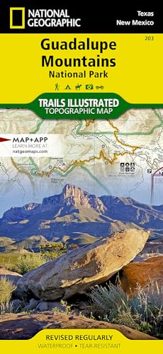
Guadalupe Mountains National Park Map (National Geographic Trails Illustrated Map, 203)

� Waterproof � Tear-Resistant � Topographic Map
Created in cooperation with the National Park Service and others, National Geographic's Trails Illustrated map of Guadalupe Mountains National Park is a complete travel guide to this pristine wilderness area. The map includes expertly researched information about the trees, shrubs, birds, amphibians and other flora and fauna that live in the the park's three ecosystems. The park's geologic history, which dates back nearly 300 million years, is explained as well.
Outdoor enthusiasts will be able to explore the area following precisely mapped trails, which include mileage markers and are color-coded according to their designated usage. Campgrounds, primitive campsites, picnic areas and points of interest along the trails are marked. To aid in your navigation of the area, the map also displays contour lines, elevations, labeled peaks, four-wheel drive and high clearance roads, water features and various waypoints. Additionally a campground to campground mileage chart will help you plans your journey. The map covers map popular points of interest, including Lincoln National Forest, Guadalupe Mountains and Guadalupe Mountains Wilderness. An inset regional map will assist you accessing the park and the nearby Carlsbad Caverns National Park.
Every Trails Illustrated map is printed on "Backcountry Tough" waterproof, tear-resistant paper. A full UTM grid is printed on the map to aid with GPS navigation.
Other features found on this map include: Brokeoff Mountains, Carlsbad Caverns National Park, Guadalupe Mountains, Guadalupe Mountains National Park, Guadalupe Peak, Lincoln National Forest.
- Map Scale = 1:35,000
- Sheet Size = 37.75" x 25.5"
- Folded Size = 4.25" x 9.25"
"synopsis" may belong to another edition of this title.
About the Author:
Founded in 1915 as the Cartographic Group, the first division of National Geographic, National Geographic Maps has been responsible for illustrating the world around us through the art and science of mapmaking.Today, National Geographic Maps continues this mission by creating the world's best wall maps, recreation maps, atlases, and globes which inspire people to care about and explore their world.
"About this title" may belong to another edition of this title.
- PublisherNational Geographic Maps
- Publication date2023
- ISBN 10 1566953162
- ISBN 13 9781566953160
- BindingMap
- Number of pages2
Buy New
Learn more about this copy
US$ 12.82
Shipping:
US$ 3.99
Within U.S.A.
Top Search Results from the AbeBooks Marketplace
Stock Image
Guadalupe Mountains National Park (National Geographic Trails Illustrated Map (203))
Published by
National Geographic Maps
(2023)
ISBN 10: 1566953162
ISBN 13: 9781566953160
New
Quantity: 2
Seller:
Rating
Book Description Condition: New. Brand New! Not Overstocks or Low Quality Book Club Editions! Direct From the Publisher! We're not a giant, faceless warehouse organization! We're a small town bookstore that loves books and loves it's customers! Buy from Lakeside Books!. Seller Inventory # OTF-S-9781566953160
Buy New
US$ 12.82
Convert currency
Stock Image
Guadalupe Mountains National Park Map (National Geographic Trails Illustrated Map, 203)
Published by
National Geographic Maps
(2023)
ISBN 10: 1566953162
ISBN 13: 9781566953160
New
Quantity: 4
Seller:
Rating
Book Description Condition: New. Seller Inventory # I-9781566953160
Buy New
US$ 17.00
Convert currency
Stock Image
Guadalupe Mountains National Park Map (National Geographic Trails Illustrated Map, 203)
Published by
National Geographic Maps
(2023)
ISBN 10: 1566953162
ISBN 13: 9781566953160
New
Quantity: 1
Seller:
Rating
Book Description Condition: New. Book is in NEW condition. 0.2. Seller Inventory # 1566953162-2-1
Buy New
US$ 19.39
Convert currency
Stock Image
Guadalupe Mountains National Park Map (National Geographic Trails Illustrated Map, 203)
Published by
National Geographic Maps
(2023)
ISBN 10: 1566953162
ISBN 13: 9781566953160
New
Quantity: 1
Seller:
Rating
Book Description Condition: New. New! This book is in the same immaculate condition as when it was published 0.2. Seller Inventory # 353-1566953162-new
Buy New
US$ 19.40
Convert currency
Stock Image
203 Guadalupe Mountains -TX natg (National Geographic Maps: Trails Illustrated)
Published by
Natl Geographic Society Maps
(2007)
ISBN 10: 1566953162
ISBN 13: 9781566953160
New
Quantity: 1
Seller:
Rating
Book Description Map. Condition: New. Seller Inventory # DADAX1566953162
Buy New
US$ 19.43
Convert currency
Stock Image
Guadalupe Mountains National Park
Published by
National Geographic Maps Division 2012-08-02, Washington, D.C.
(2012)
ISBN 10: 1566953162
ISBN 13: 9781566953160
New
Quantity: 1
Seller:
Rating
Book Description sheet map (folded). Condition: New. Language: ENG. Seller Inventory # 9781566953160
Buy New
US$ 17.03
Convert currency
Stock Image
National Geographic Trails Illustrated Map Guadalupe Mountains National Park Texas, USA: Outdoor Recreation Map
Published by
Natl Geographic Society Maps
(2007)
ISBN 10: 1566953162
ISBN 13: 9781566953160
New
Quantity: 2
Seller:
Rating
Book Description Map. Condition: Brand New. map edition. 2 pages. 0.25x9.25x4.25 inches. In Stock. Seller Inventory # x-1566953162
Buy New
US$ 15.26
Convert currency
Seller Image
Guadalupe Mountains National Park (National Geographic Trails Illustrated Map, 203)
Published by
National Geographic Maps
(2023)
ISBN 10: 1566953162
ISBN 13: 9781566953160
New
Quantity: 1
Seller:
Rating
Book Description Condition: new. 2020. Book is in NEW condition. Satisfaction Guaranteed! Fast Customer Service!!. Seller Inventory # PSN1566953162
Buy New
US$ 32.50
Convert currency
Seller Image
Guadalupe Mountains National Park
Published by
National Geographic Maps
(2009)
ISBN 10: 1566953162
ISBN 13: 9781566953160
New
Karte/Landkarte
Quantity: 4
Seller:
Rating
Book Description Karte/Landkarte. Condition: New. KlappentextCoverage includes Lincoln National Forest, Lonesome Ridge WSA, Devils Den Canyon WSA, McKittrick Canyon WSA, Guadalupe Mountains Wilderness. Includes UTM grids for use with your GPS unit. Seller Inventory # 329707893
Buy New
US$ 17.47
Convert currency