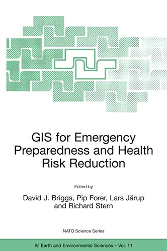
GIS for Emergency Preparedness and Health Risk Reduction (NATO Science Series: IV:, 11) - Softcover

The important matters discussed here include the probabilistic nature of most environmental hazards and the semi-random factors that influence interactions between these and human exposures; the effects of temporal and spatial scales on hazard assessment and imputed risk; the effects of measurement error in risk estimation and the stratification of risks and their impacts according to socioeconomic characteristics; and the quantification of socioeconomic differences in vulnerability and susceptibility to environmental hazards.
"synopsis" may belong to another edition of this title.
- PublisherSpringer
- Publication date2002
- ISBN 10 140200799X
- ISBN 13 9781402007996
- BindingPaperback
- Number of pages339
- EditorBriggs David J., Forer Pip, Järup Lars, Stern Richard
Buy New
Learn more about this copy
Shipping:
US$ 24.76
From Germany to U.S.A.
Top Search Results from the AbeBooks Marketplace
GIS for Emergency Preparedness and Health Risk Reduction
Book Description Taschenbuch. Condition: Neu. This item is printed on demand - it takes 3-4 days longer - Neuware -Geographical Information Systems (GIS) have developed rapidly in recent years and now provide powerful tools for the capture, manipulation, integration, interrogation, modelling, analysis and visualisation of data - tools that are already used for policy support in a wide range of areas at almost all geographic and administrative levels. This holds especially for emergency preparedness and health risk reduction, which are all essentially spatial problems. To date, however, many initiatives have remained disconnected and uncoordinated, leading to less powerful, less compatible and less widely implemented systems than might otherwise have been the case. The important matters discussed here include the probabilistic nature of most environmental hazards and the semi-random factors that influence interactions between these and human exposures; the effects of temporal and spatial scales on hazard assessment and imputed risk; the effects of measurement error in risk estimation and the stratification of risks and their impacts according to socioeconomic characteristics; and the quantification of socioeconomic differences in vulnerability and susceptibility to environmental hazards. 344 pp. Englisch. Seller Inventory # 9781402007996
GIS for Emergency Preparedness and Health Risk Reduction (NATO Science Series: IV:, 11)
Book Description Condition: New. Seller Inventory # ABLIING23Mar2411530141305
GIS for Emergency Preparedness and Health Risk Reduction
Book Description Condition: New. PRINT ON DEMAND Book; New; Fast Shipping from the UK. No. book. Seller Inventory # ria9781402007996_lsuk
GIS for Emergency Preparedness and Health Risk Reduction
Book Description Paperback / softback. Condition: New. This item is printed on demand. New copy - Usually dispatched within 5-9 working days. Seller Inventory # C9781402007996
GIS for Emergency Preparedness and Health Risk Reduction
Book Description Condition: New. Dieser Artikel ist ein Print on Demand Artikel und wird nach Ihrer Bestellung fuer Sie gedruckt. Proceedings of the NATO Advanced Research Workshop, held in Budapest, Hungary, 22-25 April 2001 Geographical Information Systems (GIS) have developed rapidly in recent years and now provide powerful tools for the capture, manipulation, integration, in. Seller Inventory # 4092115
GIS for Emergency Preparedness and Health Risk Reduction
Book Description Taschenbuch. Condition: Neu. Druck auf Anfrage Neuware - Printed after ordering - Geographical Information Systems (GIS) have developed rapidly in recent years and now provide powerful tools for the capture, manipulation, integration, interrogation, modelling, analysis and visualisation of data - tools that are already used for policy support in a wide range of areas at almost all geographic and administrative levels. This holds especially for emergency preparedness and health risk reduction, which are all essentially spatial problems. To date, however, many initiatives have remained disconnected and uncoordinated, leading to less powerful, less compatible and less widely implemented systems than might otherwise have been the case. The important matters discussed here include the probabilistic nature of most environmental hazards and the semi-random factors that influence interactions between these and human exposures; the effects of temporal and spatial scales on hazard assessment and imputed risk; the effects of measurement error in risk estimation and the stratification of risks and their impacts according to socioeconomic characteristics; and the quantification of socioeconomic differences in vulnerability and susceptibility to environmental hazards. Seller Inventory # 9781402007996

