Hebden Bridge 1905: Yorkshire Sheet 230.01 (Old O.S. Maps of Yorkshire)

Buy New
Learn more about this copy
US$ 3.80
Shipping:
US$ 38.04
From United Kingdom to U.S.A.
Top Search Results from the AbeBooks Marketplace
Stock Image
Hebden Bridge 1905: Yorkshire Sheet 230.01 (Old O.S. Maps of Yorkshire)
Seller:
Rating
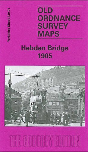
Book Description No Binding. Condition: New. No Jacket. Here are the details of maps for Hebden Bridge: Yorkshire Sheet 230.01 Hebden Bridge 1905 - published 1997; intro by Gordon Dickinson. ISBN.978-0-85054-877-8 This detailed map covers the popular town of Hebden Bridge, and coverage also continues NE to the hamlet of Chisley. Most of Hebden Bridge town is shown and features here include railway station, Rochdale Canal, Calder Mill, Bank Foot Bridge, Hanging Royd House, Nutclough Works, Machpelah, Birchcliffe, Foster Mill, Fairfield, May Royd Mill, Wood End, Owler Bank, Hebden Water. The village of Heptonstall is in the top left corner, with St Thomas church. Eastward is Chisley, with Acre Mill, and south of this is Little Moor, with scattered cottages and the Mount Skip Inn. On the reverse we include a commercial directory of the town in 1901. Seller Inventory # 002217
Buy New
US$ 3.80
Convert currency