Hulme: St.George's 1849: Manchester Sheet 37 (Old Ordnance Survey Maps of Manchester)
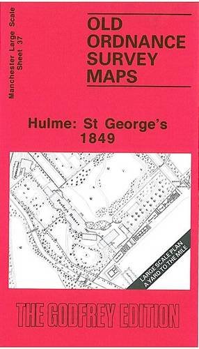

Here are the details of maps for Hulme (West): Manchester Sheet 37 Hulme: St George's 1849 - published 1995; intro by Chris Makepeace. ISBN.978-0-85054-727-6 This extremely detailed map covers the western part of Hulme and eastern part of Cornbrook. Coverage stretches from Stretford Road eastward to York Street, and from Chester Road southward to Cedar Street. St George's church is split by the top margin. Features include Cavalry Barracks (shown in considerable detail), Pooleys Houses, Commercial Mill, part of Cornbrook Park, stretch of Bridgewater Canal, Crossford Bridge & Manchester Trust turnpike, Moss Lane. The area is greatly changed today. On the reverse we include street directory entries for Bedford Street, Brook Street, Chester Road, Lloyd Street, Moss Lane, Queen Street, Worcester Street, York Street.
"synopsis" may belong to another edition of this title.
- PublisherAlan Godfrey Maps
- Publication date1995
- ISBN 10 085054727X
- ISBN 13 9780850547276
- BindingMap
Buy New
Learn more about this copy
US$ 14.14
Shipping:
FREE
Within U.S.A.
Top Search Results from the AbeBooks Marketplace
Stock Image
Hulme StGeorge's 1849 Manchester Sheet 37 Old Ordnance Survey Maps of Manchester
Seller:
Rating
Book Description PAP. Condition: New. New Book. Shipped from UK. Established seller since 2000. Seller Inventory # GB-9780850547276
Buy New
US$ 14.14
Convert currency
Stock Image
Hulme And St.George's
Seller:
Rating
Book Description Map. Condition: Brand New. facsimile of 1849 ed edition. 8.19x4.65x0.16 inches. In Stock. Seller Inventory # __085054727X
Buy New
US$ 4.32
Convert currency
Stock Image
Hulme: St.George's 1849: Manchester Sheet 37 (Old Ordnance Survey Maps of Manchester)
Seller:
Rating
Book Description Map. Condition: New. BRAND NEW ** SUPER FAST SHIPPING FROM UK WAREHOUSE ** 30 DAY MONEY BACK GUARANTEE. Seller Inventory # 9780850547276-GDR
Buy New
US$ 7.64
Convert currency
Stock Image
Hulme: St.George's 1849: Manchester Sheet 37
Seller:
Rating
Book Description Sheet map, folded. Condition: New. New copy - Usually dispatched within 4 working days. Seller Inventory # B9780850547276
Buy New
US$ 7.75
Convert currency
Stock Image
Hulme: St.George's 1849: Manchester Sheet 37 (Old Ordnance Survey Maps of Manchester)
Seller:
Rating
Book Description Condition: New. In. Seller Inventory # ria9780850547276_new
Buy New
US$ 7.17
Convert currency
Stock Image
Hulme: St.George's 1849
Seller:
Rating
Book Description Condition: New. 2012. Facsim.of 1849 Ed. Map. Series: Old Ordnance Survey Maps of Manchester. BIC Classification: 1DBKENL; 3JH; WQH; WTRM. Category: (G) General (US: Trade). Dimension: 199 x 121 x 3. Weight in Grams: 24. . . . . . Books ship from the US and Ireland. Seller Inventory # V9780850547276
Buy New
US$ 10.79
Convert currency
Stock Image
Hulme: St.George's 1849
Seller:
Rating
Book Description Condition: New. 2012. Facsim.of 1849 Ed. Map. Series: Old Ordnance Survey Maps of Manchester. BIC Classification: 1DBKENL; 3JH; WQH; WTRM. Category: (G) General (US: Trade). Dimension: 199 x 121 x 3. Weight in Grams: 24. . . . . . Seller Inventory # V9780850547276
Buy New
US$ 10.25
Convert currency
Seller Image
Hulme: St.George's 1849 : Manchester Sheet 37
Published by
Alan Godfrey Maps Apr 1995
(1995)
ISBN 10: 085054727X
ISBN 13: 9780850547276
New
Quantity: 2
Seller:
Rating
Book Description Karte. Condition: Neu. Neuware Deutsch. Seller Inventory # 9780850547276
Buy New
US$ 4.92
Convert currency
Stock Image
Hulme StGeorge's 1849 Manchester Sheet 37 Old Ordnance Survey Maps of Manchester
Seller:
Rating
Book Description PAP. Condition: New. New Book. Shipped from UK. Established seller since 2000. Seller Inventory # GB-9780850547276
Buy New
US$ 9.51
Convert currency
Stock Image
Hulme: St.George's 1849: Manchester Sheet 37 (Old Ordnance Survey Maps of Manchester)
Seller:
Rating
Book Description No Binding. Condition: New. No Jacket. Here are the details of maps for Hulme (West): Manchester Sheet 37 Hulme: St George's 1849 - published 1995; intro by Chris Makepeace. ISBN.978-0-85054-727-6 This extremely detailed map covers the western part of Hulme and eastern part of Cornbrook. Coverage stretches from Stretford Road eastward to York Street, and from Chester Road southward to Cedar Street. St George's church is split by the top margin. Features include Cavalry Barracks (shown in considerable detail), Pooleys Houses, Commercial Mill, part of Cornbrook Park, stretch of Bridgewater Canal, Crossford Bridge & Manchester Trust turnpike, Moss Lane. The area is greatly changed today. On the reverse we include street directory entries for Bedford Street, Brook Street, Chester Road, Lloyd Street, Moss Lane, Queen Street, Worcester Street, York Street. The map links up with Manchester Sheets 32 Castlefield to the north, 38 Hulme to the east. Seller Inventory # 000422
Buy New
US$ 3.55
Convert currency