Whitfield, Peter Charting the Oceans ISBN 13: 9780712356169

Charting the Oceans - Softcover
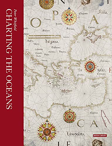
9780712356169: Charting the Oceans
View all copies of this ISBN edition:
 
 
Mastery of the sea has been crucial in world history: the transition from the medieval to the modern world was marked by the emergence of ships from their European home waters out into the Atlantic, Indian and Pacific Oceans. Solving the problem of ocean navigation was an essential prelude to achieving international powers and the maritime nations left a unique visual record of their response to the challenge of the sea. In succession Spanish, Portuguese, Dutch, French and English mariners used their charts to express their claims to sovereignty of the seas and territories newly revealed by their naval explorers. This revised and updated book traces the history of charts not as technical documents but as eloquent witnesses to the discovery of the world beyond Europe, and to man’s evolving knowledge of the oceans. These charts employed a vivid artistic idiom which expressed man’s passionate feeling for the sea: the gilded compasses, the nightmarish sea-creatures, the stately ships, the royal crests—all these were fused into a unique art-form, which flourished for four centuries. Featuring new photography of the British Library’s most important maritime maps, Charting the Oceans is the definitive guide to this majestic tradition.

"synopsis" may belong to another edition of this title.

About the Author:
Peter Whitfield is a leading expert in map history and exploration. His previous books include London: A Life in Maps and Cities of the World: A History in Maps.

"About this title" may belong to another edition of this title.

  • PublisherBritish Library Publishing
  • Publication date2017
  • ISBN 10 0712356169
  • ISBN 13 9780712356169
  • BindingPaperback
  • Edition number2
  • Number of pages208
  • Rating

Shipping: US$ 25.54
From United Kingdom to U.S.A.

Destination, rates & speeds

Add to Basket

Top Search Results from the AbeBooks Marketplace

Stock Image

Peter Whitfield
Published by The British Library (2017)
ISBN 10: 0712356169 ISBN 13: 9780712356169
New Soft cover First Edition Quantity: 1
Seller:
Paul Hughes - PBFA
(Bishop Auckland, United Kingdom)

Book Description Soft cover. Condition: New. 1st Edition. Seller Inventory # ABE-1712479919446

More information about this seller | Contact seller

Buy New
US$ 15.79
Convert currency

Add to Basket

Shipping: US$ 25.54
From United Kingdom to U.S.A.
Destination, rates & speeds
Stock Image

Whitfield, Peter
Published by British Library Board (2017)
ISBN 10: 0712356169 ISBN 13: 9780712356169
New Paperback Quantity: 1
Seller:
Revaluation Books
(Exeter, United Kingdom)

Book Description Paperback. Condition: Brand New. reprint edition. 208 pages. 10.75x8.50x0.75 inches. In Stock. Seller Inventory # zk0712356169

More information about this seller | Contact seller

Buy New
US$ 29.77
Convert currency

Add to Basket

Shipping: US$ 12.77
From United Kingdom to U.S.A.
Destination, rates & speeds
Stock Image

Peter Whitfield
Published by British Library (2017)
ISBN 10: 0712356169 ISBN 13: 9780712356169
New Paperback Quantity: > 20
Seller:
Postscript Books
(Newton Abbot, DEVON, United Kingdom)

Book Description Paperback. Condition: New. From the simple pilot books (periploi) and eight-pointed wind roses used by ancient Mediterranean mariners, this richly illustrated history follows the development of sea-charts up to British Admiralty charts from the Crimean, Opium and First World Wars. Focusing on the period from 1400 to 1900, Peter Whitfield examines the Europeans' enterprise of charting the world in relation to their expanding knowledge of other oceans and lands, driven by the commercial need for navigational and maritime information. Seller Inventory # 516775

More information about this seller | Contact seller

Buy New
US$ 5.25
Convert currency

Add to Basket

Shipping: US$ 40.87
From United Kingdom to U.S.A.
Destination, rates & speeds